|
search place name
|
||
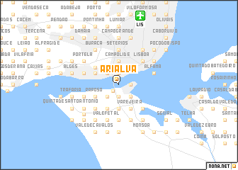
Arialva (Setúbal, Portugal)Arialva is a town in the Setúbal region of Portugal. An overview map of the region around Arialva is displayed below.
regional and 3d topo map of Arialva, Portugal ::
nearby GPS traces from timatio ::
Arialva airports ::
The nearest airport is LIS - Lisbon Lisboa, located 11.2 km north of Arialva.
Other airports nearby include FAO - Faro (213.3 km south east), Nearby towns ::
Raposo (1.2km south west) //
São Pedro (1.9km south) //
Pragal (1.9km south) //
Margueira (1.4km east) //
Almada (1.4km east) //
Cacilhas (1.4km east) //
Alcântara (1.9km north) //
Bicheiro (2.4km south west) //
Piedade (2.4km south east) //
Cova da Piedade (2.4km south east) //
Barrocas (2.4km south east) //
Caramujo (2.4km south east) //
Mutela (2.4km south east) //
Santo Amaro (2.4km north west) //
Carapinha (3.7km south) //
Campolide (3.7km north) //
Fonte Santa (3.4km south west) //
Murrião (3.4km south west) //
Caparica (3.4km south west) //
Raposo (3.4km south west) //
Banatica (3.4km south west) //
Porto Brandão (3.4km south west) //
Castelo Picão (3.4km south west) //
Sobreda (4.0km south) //
Ajuda (3.4km north west) //
Belém (3.4km north west) //
Bairro do Alto da Ajuda (3.4km north west) //
Varejeira (4.0km south) //
Laranjeira (4.0km south) //
[all distances 'as the bird flies' and approximate] 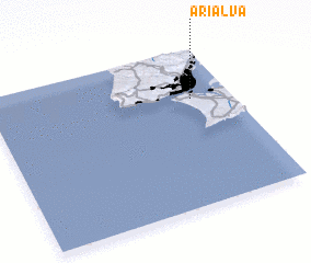 Places with similar names to Arialva, Portugal ::
Disclaimer :: Information on this page comes without warranty of any kind |
||
|
Where is Arialva? Elevation and coordinates ::
Latitude (lat): 38°41'0"N Longitude (lon): 9°10'0"W
Elevation (approx.): -32768m (map arrows pan, magnifying glasses zoom) |
||
|
Visiting Arialva? Hotel/Accommodation ::
Book a hotel in Arialva Travel Guide ::
Buy a travel guide for Portugal rental cars ::
car rental offers GPS waypoint ::
download a GPX waypoint (PoI) of Arialva for your GPS receiver
|
||