|
search place name
|
||
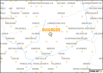
Avidagos (Bragança, Portugal)Avidagos is a town in the Bragança region of Portugal. An overview map of the region around Avidagos is displayed below.
regional and 3d topo map of Avidagos, Portugal ::
Avidagos airports ::
The nearest airport is VRL - Vila Real, located 37.9 km west of Avidagos.
Other airports nearby include BGC - Braganca (70.9 km north east), OPO - Porto (116.9 km west), VGO - Vigo (143.8 km north west), SLM - Salamanca (158.9 km east), Nearby towns ::
Pereira (2.3km north west) //
Navalho (2.3km south east) //
Carvalhal (2.3km south east) //
Palorca (2.3km south west) //
Rego de Vide (3.3km north east) //
Lamas de Orelhão (4.0km north) //
Abreiro (5.6km south) //
Vila Boa (4.2km west) //
Cobro (4.6km north east) //
Longra (5.6km south east) //
Milhais (6.2km south west) //
Fonte da Urze (5.6km north east) //
Franco (5.6km north west) //
Varges (5.6km west) //
Codeçais (7.5km south) //
Monfebres (5.9km west) //
Sobreira (7.0km south west) //
Barcel (6.7km south east) //
Ribeirinha (6.7km south east) //
Vieiro (7.9km south) //
Passos (7.9km north) //
Vales (8.5km north west) //
[all distances 'as the bird flies' and approximate] 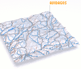 Places with similar names to Avidagos, Portugal :: Disclaimer :: Information on this page comes without warranty of any kind |
||
|
Where is Avidagos? Elevation and coordinates ::
Latitude (lat): 41°24'0"N Longitude (lon): 7°18'0"W
Elevation (approx.): 489m (map arrows pan, magnifying glasses zoom) |
||
|
Visiting Avidagos? Hotel/Accommodation ::
Book a hotel in Avidagos Travel Guide ::
Buy a travel guide for Portugal rental cars ::
car rental offers GPS waypoint ::
download a GPX waypoint (PoI) of Avidagos for your GPS receiver
|
||