|
search place name
|
||
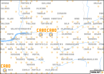
Cabo (Viana do Castelo, Portugal)Cabo is a town in the Viana do Castelo region of Portugal. An overview map of the region around Cabo is displayed below.
regional and 3d topo map of Cabo, Portugal ::
Cabo airports ::
The nearest airport is VGO - Vigo, located 26.2 km north west of Cabo.
Other airports nearby include SCQ - Santiago (92.2 km north), OPO - Porto (93.9 km south), VRL - Vila Real (104.6 km south east), LCG - La Coruna A Coruna (137.2 km north), Nearby towns ::
Ponte de Mouro (0.0km north) //
Barbeita (0.0km north) //
Setados (1.9km north) //
Abeção (1.4km west) //
Ceivães (1.4km east) //
Burnaria (1.4km west) //
Valinha (1.4km east) //
Araújo (1.4km west) //
Moujuzão (1.4km east) //
Moucheira (1.4km east) //
Poldras (1.9km south) //
Vide (2.3km north east) //
Nieves (2.3km north west) //
Segude (2.3km south east) //
Paradela (2.3km south east) //
Porqueira (2.3km south west) //
Giesteira (2.8km west) //
Cabo (2.8km west) //
São Bento (2.8km west) //
Marco (2.8km west) //
Bela (2.8km west) //
Torre de Cima (2.8km east) //
Badim (2.8km east) //
Paço Velho (2.8km east) //
Pica (3.7km south) //
Pereiras (3.7km south) //
Quinteiro (3.7km south) //
Merim (3.7km south) //
Pretos (3.7km south) //
[all distances 'as the bird flies' and approximate]  Places with similar names to Cabo, Portugal ::
Disclaimer :: Information on this page comes without warranty of any kind |
||
|
Where is Cabo? Elevation and coordinates ::
Latitude (lat): 42°4'0"N Longitude (lon): 8°24'0"W
Elevation (approx.): 110m (map arrows pan, magnifying glasses zoom) |
||
|
Visiting Cabo? Hotel/Accommodation ::
Book a hotel in Cabo Travel Guide ::
Buy a travel guide for Portugal rental cars ::
car rental offers GPS waypoint ::
download a GPX waypoint (PoI) of Cabo for your GPS receiver
|
||