|
search place name
|
||
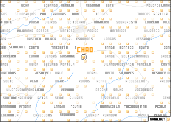
Chão (Braga, Portugal)Chão is a town in the Braga region of Portugal. An overview map of the region around Chão is displayed below.
regional and 3d topo map of Chão, Portugal ::
Chão airports ::
The nearest airport is OPO - Porto, located 34.3 km south west of Chão.
Other airports nearby include VRL - Vila Real (62.7 km east), VGO - Vigo (84.9 km north), BGC - Braganca (148.3 km east), SCQ - Santiago (157.0 km north), Nearby towns ::
Penso (0.0km north) //
Hospital (1.4km west) //
Escudeiros (1.4km west) //
Penso (1.4km west) //
Monte (1.4km west) //
Leitões (1.4km east) //
Além (1.9km north) //
Trandeiras (1.9km north) //
Morreira (1.9km north) //
Figueiredo (2.3km south east) //
Oleiros (2.3km south east) //
São Miguel (2.3km north west) //
Santo António (2.3km north west) //
Lamas (2.3km north west) //
Quintãis (2.3km south east) //
Figueiredo (2.3km north west) //
Airão (3.7km south) //
Guisande (2.8km west) //
Cabreira (2.8km east) //
Arcos (3.7km north) //
Esporões (3.7km north) //
Portela (3.3km south west) //
Vermil (4.0km south) //
Pipe (3.3km north west) //
Outinho (3.3km north east) //
Balazar (3.3km north east) //
Telhado (4.6km south west) //
Andrias (4.6km north west) //
Misericórdia (4.6km north west) //
[all distances 'as the bird flies' and approximate] 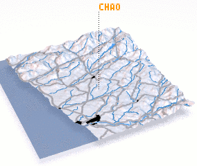 Places with similar names to Chão, Portugal ::
Disclaimer :: Information on this page comes without warranty of any kind |
||
|
Where is Chão? Elevation and coordinates ::
Latitude (lat): 41°29'0"N Longitude (lon): 8°25'0"W
Elevation (approx.): 234m (map arrows pan, magnifying glasses zoom) |
||
|
Visiting Chão? Hotel/Accommodation ::
Book a hotel in Chão Travel Guide ::
Buy a travel guide for Portugal rental cars ::
car rental offers GPS waypoint ::
download a GPX waypoint (PoI) of Chão for your GPS receiver
|
||