|
search place name
|
||
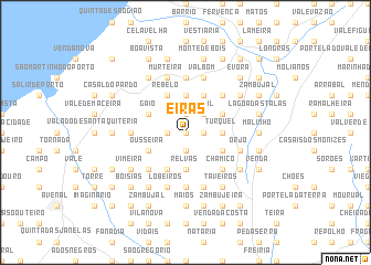
Eiras (Leiria, Portugal)Eiras is a town in the Leiria region of Portugal. An overview map of the region around Eiras is displayed below.
regional and 3d topo map of Eiras, Portugal ::
Eiras airports ::
The nearest airport is LIS - Lisbon Lisboa, located 76.8 km south of Eiras.
Other airports nearby include OPO - Porto (199.8 km north), VRL - Vila Real (228.9 km north east), Nearby towns ::
Vimeiro (0.0km north) //
Cumeira (1.4km west) //
Arroteia Nova (1.9km north) //
Santa Catarina (1.9km south) //
Louções (1.4km east) //
Silval (2.3km north east) //
Cipreste (3.7km north) //
Relvas (3.7km south) //
Turquel (2.9km east) //
Ribeira do Mareto (3.4km north west) //
Gaio (3.4km north west) //
Rebelo (4.0km north) //
Ousseira (3.4km south west) //
Casais da Fragosa (4.0km north) //
Abrunheira (4.0km south) //
Costa do Ardido (3.4km north east) //
Ardido (3.4km north east) //
Poço das Vinhas (3.4km north east) //
Portela do Pereiro (3.4km north east) //
Frazões (3.4km south east) //
Cabeça Alta (4.7km south west) //
Carvalhal Bemfeito (4.7km south west) //
Ninho de Águia (4.7km north east) //
Chamiço (4.7km south east) //
Mata de Porto Moiro (5.6km south) //
Peso (4.3km west) //
Mestras (4.3km west) //
Sete Lenços (5.6km north) //
Casal da Carreira (5.6km north) //
[all distances 'as the bird flies' and approximate] 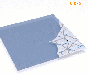 Places with similar names to Eiras, Portugal ::
Disclaimer :: Information on this page comes without warranty of any kind |
||
|
Where is Eiras? Elevation and coordinates ::
Latitude (lat): 39°28'0"N Longitude (lon): 9°1'0"W
Elevation (approx.): 68m (map arrows pan, magnifying glasses zoom) |
||
|
Visiting Eiras? Hotel/Accommodation ::
Book a hotel in Eiras Travel Guide ::
Buy a travel guide for Portugal rental cars ::
car rental offers GPS waypoint ::
download a GPX waypoint (PoI) of Eiras for your GPS receiver
|
||