|
search place name
|
||
Falagueira (Portalegre, Portugal)Falagueira is a town in the Portalegre region of Portugal. An overview map of the region around Falagueira is displayed below.
regional and 3d topo map of Falagueira, Portugal ::

Falagueira airports ::
The nearest airport is BJZ - Badajoz Talavera La Real, located 107.3 km south east of Falagueira.
Other airports nearby include LIS - Lisbon Lisboa (146.0 km south west), VRL - Vila Real (193.3 km north), OPO - Porto (206.2 km north), Nearby towns ::
Monte dos Matos (2.3km north east) //
Albarrol (2.9km west) //
Monte Claro (2.9km east) //
São Pedro (4.0km north) //
Silveira (4.7km north west) //
Vila Flor (4.7km south west) //
Chão da Velha (5.7km north) //
Gardete (4.7km north west) //
Arez (5.7km south) //
Riscada (6.3km north west) //
Cacheiro (5.7km north east) //
Velada (5.7km north east) //
Juncal (7.5km north) //
Vermum (7.5km north) //
Barca da Amieira (6.8km south west) //
Padrão (9.4km north west) //
Pardo (9.4km north east) //
[all distances 'as the bird flies' and approximate] 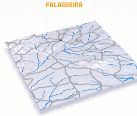 Places with similar names to Falagueira, Portugal ::
// Velgur (RU)
// Valkaria (US)
// Felegara (IT)
// Folgaria (IT)
// Voulgáro (GR)
// Falagueira (PT)
// Falagueiro (PT)
// Felgar (PT)
// Felgaria (PT)
// Felgueira (PT)
Disclaimer :: Information on this page comes without warranty of any kind |
||
|
Where is Falagueira? Elevation and coordinates ::
Latitude (lat): 39°32'0"N Longitude (lon): 7°45'0"W
Elevation (approx.): 274m (map arrows pan, magnifying glasses zoom) |
||
|
Visiting Falagueira? Hotel/Accommodation ::
Book a hotel in Falagueira Travel Guide ::
Buy a travel guide for Portugal rental cars ::
car rental offers GPS waypoint ::
download a GPX waypoint (PoI) of Falagueira for your GPS receiver
|
||