|
search place name
|
||
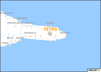
Fetais (Açores, Portugal)Fetais is a town in the Açores region of Portugal. An overview map of the region around Fetais is displayed below.
regional and 3d topo map of Fetais, Portugal ::
Fetais airports ::
The nearest airport is SJZ - Sao Jorge Island Sao Jorge, located 28.8 km north of Fetais.
Other airports nearby include PIX - Pico (34.8 km north west), HOR - Horta (56.4 km west), GRW - Graciosa Island Graciosa (75.1 km north), TER - Lajes (terceira Island) Lajes (94.6 km north east), Nearby towns ::
Piedade (1.5km east) //
Cruz do Redondo (1.5km east) //
Altamora (1.5km east) //
Adegas (1.9km south) //
Calheta de Nesquim (1.9km south) //
Feiteira (2.4km south east) //
Adegas (3.7km north) //
Foros (2.9km west) //
Cais do Galego (3.4km north east) //
Ribeirinha (4.0km north) //
Ribeira Grande (4.4km west) //
Manhenha (4.4km east) //
Ribeira Seca (5.8km west) //
Terra Alta (6.9km north west) //
[all distances 'as the bird flies' and approximate] 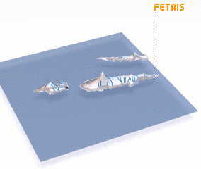 Places with similar names to Fetais, Portugal ::
Disclaimer :: Information on this page comes without warranty of any kind |
||
|
Where is Fetais? Elevation and coordinates ::
Latitude (lat): 38°25'0"N Longitude (lon): 28°5'0"W
Elevation (approx.): 301m (map arrows pan, magnifying glasses zoom) |
||
|
Visiting Fetais? Hotel/Accommodation ::
Book a hotel in Fetais Travel Guide ::
Buy a travel guide for Portugal rental cars ::
car rental offers GPS waypoint ::
download a GPX waypoint (PoI) of Fetais for your GPS receiver
|
||