|
search place name
|
||
Murtinheira (Coimbra, Portugal)Murtinheira is a town in the Coimbra region of Portugal. An overview map of the region around Murtinheira is displayed below.
regional and 3d topo map of Murtinheira, Portugal ::

Murtinheira airports ::
The nearest airport is OPO - Porto, located 116.0 km north of Murtinheira.
Other airports nearby include VRL - Vila Real (154.0 km north east), LIS - Lisbon Lisboa (160.6 km south), Nearby towns ::
Palheiros de Quiaios (1.4km east) //
Vais (3.7km south) //
Boa Viagem (4.7km south east) //
Quiaios (4.2km east) //
Buarcos (5.7km south) //
Casal da Fonte Nova (5.7km south) //
Praia (6.2km south east) //
Brenha (6.0km east) //
Cabanas (6.0km east) //
Senhor da Arieira (7.0km south east) //
Tavarede (7.0km south east) //
Condados (7.0km south east) //
Figueira da Foz (7.9km south) //
Caratão (6.8km south west) //
Saltadouro (6.8km south east) //
Esperança (8.5km south east) //
Casal do Rato (8.5km south east) //
Casal da Rebala (9.3km south east) //
[all distances 'as the bird flies' and approximate] 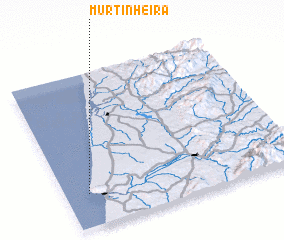 Places with similar names to Murtinheira, Portugal ::
// Murtinheira (PT)
// Mardānheri (IN)
Disclaimer :: Information on this page comes without warranty of any kind |
||
|
Where is Murtinheira? Elevation and coordinates ::
Latitude (lat): 40°13'0"N Longitude (lon): 8°54'0"W
Elevation (approx.): -32768m (map arrows pan, magnifying glasses zoom) |
||
|
Visiting Murtinheira? Hotel/Accommodation ::
Book a hotel in Murtinheira Travel Guide ::
Buy a travel guide for Portugal rental cars ::
car rental offers GPS waypoint ::
download a GPX waypoint (PoI) of Murtinheira for your GPS receiver
|
||