|
search place name
|
||
Ordonho (Vila Real, Portugal)Ordonho is a town in the Vila Real region of Portugal. An overview map of the region around Ordonho is displayed below.
regional and 3d topo map of Ordonho, Portugal ::

Ordonho airports ::
The nearest airport is VRL - Vila Real, located 11.0 km north west of Ordonho.
Other airports nearby include OPO - Porto (88.0 km west), BGC - Braganca (106.4 km north east), VGO - Vigo (141.3 km north west), SCQ - Santiago (199.2 km north), Nearby towns ::
Gouvinhas (1.9km south) //
Donelo (2.3km south east) //
Paradela de Guiães (3.7km north) //
Guiães (2.8km west) //
Sobrados (4.0km north) //
Magalhã (4.0km north) //
Covas do Douro (3.3km south east) //
Vilela (4.6km north east) //
Roalde (5.6km north) //
São Martinho (5.7km south) //
Fontelo (4.6km north west) //
Galafura (4.6km south west) //
Marmelal (5.7km south) //
Jorjais (5.6km north west) //
Fermentões (6.2km north east) //
Chanceleiros (5.6km south east) //
Adorigo (6.2km south east) //
Fonteita (6.2km north west) //
Gouvães (5.6km east) //
Provesende (5.9km east) //
São Martinho de Antas (7.5km north) //
Abaças (5.9km west) //
Bujões (5.9km west) //
Vilarinho de São Romão (7.0km north east) //
Covelinhas (7.0km south west) //
Folgosa (7.0km south west) //
Celeirós (6.7km north east) //
Paços (7.9km north) //
São Cibrão (7.9km north) //
[all distances 'as the bird flies' and approximate] 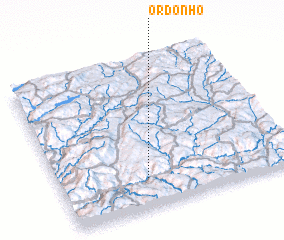 Places with similar names to Ordonho, Portugal ::
// Ordonhe (PT)
Disclaimer :: Information on this page comes without warranty of any kind |
||
|
Where is Ordonho? Elevation and coordinates ::
Latitude (lat): 41°12'0"N Longitude (lon): 7°38'0"W
Elevation (approx.): 322m (map arrows pan, magnifying glasses zoom) |
||
|
Visiting Ordonho? Hotel/Accommodation ::
Book a hotel in Ordonho Travel Guide ::
Buy a travel guide for Portugal rental cars ::
car rental offers GPS waypoint ::
download a GPX waypoint (PoI) of Ordonho for your GPS receiver
|
||