|
search place name
|
||
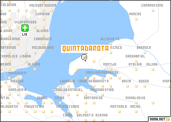
Quinta da Rota (Setúbal, Portugal)Quinta da Rota is a town in the Setúbal region of Portugal. An overview map of the region around Quinta da Rota is displayed below.
regional and 3d topo map of Quinta da Rota, Portugal ::
Quinta da Rota airports ::
The nearest airport is LIS - Lisbon Lisboa, located 12.6 km north west of Quinta da Rota.
Other airports nearby include FAO - Faro (210.3 km south east), Nearby towns ::
Samouco (1.4km east) //
Quinta do Batedoiro (2.4km south west) //
Rosairinho (3.7km south) //
Esteiro Furado (4.0km south) //
Sarilhos Pequenos (4.7km south east) //
São Francisco (4.7km north east) //
Caio (5.7km south) //
Casal da Boa Vista (5.7km south) //
Montijo (4.7km south east) //
Lavradio (6.3km south west) //
Alcochete (5.7km north east) //
Broegas (6.3km south east) //
Sarilhos Grandes (5.7km south east) //
Casal do Vale do Grou (7.4km south) //
Alhos Vedros (7.6km south) //
Barreiro (7.1km south west) //
Carregosa (7.1km south east) //
Cabeço de Alhos Vedros (8.0km south) //
Casal do Estacal (8.0km south) //
São Sebastião (8.0km south) //
Lançada (6.9km south east) //
Moita (8.0km south) //
[all distances 'as the bird flies' and approximate] 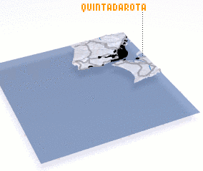 Places with similar names to Quinta da Rota, Portugal ::
// Canto do Rodeio (BR)
Disclaimer :: Information on this page comes without warranty of any kind |
||
|
Where is Quinta da Rota? Elevation and coordinates ::
Latitude (lat): 38°43'0"N Longitude (lon): 9°1'0"W
Elevation (approx.): 13m (map arrows pan, magnifying glasses zoom) |
||
|
Visiting Quinta da Rota? Hotel/Accommodation ::
Book a hotel in Quinta da Rota Travel Guide ::
Buy a travel guide for Portugal rental cars ::
car rental offers GPS waypoint ::
download a GPX waypoint (PoI) of Quinta da Rota for your GPS receiver
|
||