|
search place name
|
||
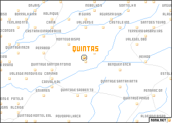
Quintas (Castelo Branco, Portugal)Quintas is a town in the Castelo Branco region of Portugal. An overview map of the region around Quintas is displayed below.
regional and 3d topo map of Quintas, Portugal ::
Quintas airports ::
The nearest airport is VRL - Vila Real, located 120.9 km north of Quintas.
Other airports nearby include BJZ - Badajoz Talavera La Real (154.6 km south), OPO - Porto (162.2 km north west), SLM - Salamanca (171.9 km north east), BGC - Braganca (187.2 km north), Nearby towns ::
Salgueiro (0.0km north) //
Escarigo (2.3km north east) //
Monte do Bispo (4.7km north west) //
Ferreira (7.4km south) //
Valverde (7.4km north) //
Quinta de São Bento (7.5km south) //
Benquerença (6.0km east) //
Quinta de Santo António (6.0km west) //
Capinha (6.8km south west) //
Santo Amaro (7.9km north) //
Carvalhal (7.9km south west) //
Quinta de Santa Marta (7.9km south east) //
Casteleiro (9.3km north east) //
Caria (9.3km north west) //
[all distances 'as the bird flies' and approximate] 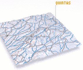 Places with similar names to Quintas, Portugal ::
Disclaimer :: Information on this page comes without warranty of any kind |
||
|
Where is Quintas? Elevation and coordinates ::
Latitude (lat): 40°14'0"N Longitude (lon): 7°18'0"W
Elevation (approx.): 460m (map arrows pan, magnifying glasses zoom) |
||
|
Visiting Quintas? Hotel/Accommodation ::
Book a hotel in Quintas Travel Guide ::
Buy a travel guide for Portugal rental cars ::
car rental offers GPS waypoint ::
download a GPX waypoint (PoI) of Quintas for your GPS receiver
|
||