|
search place name
|
||
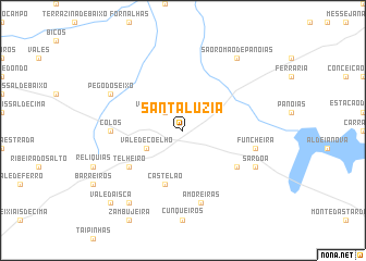
Santa Luzia (Beja, Portugal)Santa Luzia is a town in the Beja region of Portugal. An overview map of the region around Santa Luzia is displayed below.
regional and 3d topo map of Santa Luzia, Portugal ::
Santa Luzia airports ::
The nearest airport is FAO - Faro, located 88.6 km south east of Santa Luzia.
Other airports nearby include LIS - Lisbon Lisboa (133.0 km north west), BJZ - Badajoz Talavera La Real (188.6 km north east), Nearby towns ::
Vale de Santiago (2.4km north west) //
Vale de Coelho (3.5km south west) //
Amoreiras-Gare (5.8km south) //
Castelão (5.8km south) //
Telheiro (5.8km south west) //
Garvão (5.8km south east) //
Colos (5.9km west) //
Amoreiras (7.6km south) //
Funcheira (6.1km east) //
Sardoa (6.9km south east) //
Pego do Seixo (6.9km north west) //
Chaiça Madriz (8.6km south west) //
São Romão de Panoias (8.6km north east) //
Vale da Isca (9.5km south west) //
[all distances 'as the bird flies' and approximate]  Places with similar names to Santa Luzia, Portugal ::
// Santa Alice (BR)
// Santa Elisa (BR)
// Santa Elisa (BR)
// Santa Eloísa (BR)
// Santa Luísa (BR)
// Santa Luísa (BR)
// Santa Luiza (BR)
// Santa Luz (BR)
// Santa Luzia (BR)
// Santa Luzia (BR)
Disclaimer :: Information on this page comes without warranty of any kind |
||
|
Where is Santa Luzia? Elevation and coordinates ::
Latitude (lat): 37°44'0"N Longitude (lon): 8°24'0"W
Elevation (approx.): 164m (map arrows pan, magnifying glasses zoom) |
||
|
Visiting Santa Luzia? Hotel/Accommodation ::
Book a hotel in Santa Luzia Travel Guide ::
Buy a travel guide for Portugal rental cars ::
car rental offers GPS waypoint ::
download a GPX waypoint (PoI) of Santa Luzia for your GPS receiver
|
||