|
search place name
|
||
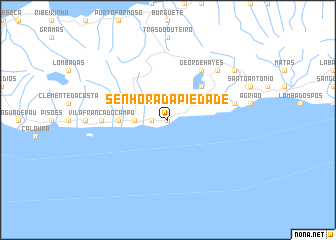
Senhora da Piedade (Açores, Portugal)Senhora da Piedade is a town in the Açores region of Portugal. An overview map of the region around Senhora da Piedade is displayed below.
regional and 3d topo map of Senhora da Piedade, Portugal ::
Senhora da Piedade airports ::
The nearest airport is PDL - Ponta Delgada, located 29.3 km west of Senhora da Piedade.
Other airports nearby include SMA - Santa Maria (island) Santa Maria (84.5 km south), TER - Lajes (terceira Island) Lajes (190.4 km north west), Nearby towns ::
Ponta Garça (0.0km north) //
Senhora da Vida (1.5km west) //
Ribeira das Tainhas (2.9km west) //
Lagoa das Furnas (4.7km north east) //
Ribeira Seca (4.4km west) //
George Hayes (6.3km north east) //
Vila Franca do Campo (5.9km west) //
Ribeira Quente (6.1km east) //
Furnas (7.1km north east) //
Estaleiro (8.1km north east) //
Caldeiras (8.1km north east) //
[all distances 'as the bird flies' and approximate] 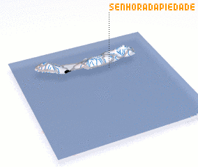 Places with similar names to Senhora da Piedade, Portugal ::
// Senhora da Piedade (PT)
// Senhora da Piedade (PT)
Disclaimer :: Information on this page comes without warranty of any kind |
||
|
Where is Senhora da Piedade? Elevation and coordinates ::
Latitude (lat): 37°43'0"N Longitude (lon): 25°22'0"W
Elevation (approx.): 85m (map arrows pan, magnifying glasses zoom) |
||
|
Visiting Senhora da Piedade? Hotel/Accommodation ::
Book a hotel in Senhora da Piedade Travel Guide ::
Buy a travel guide for Portugal rental cars ::
car rental offers GPS waypoint ::
download a GPX waypoint (PoI) of Senhora da Piedade for your GPS receiver
|
||