|
search place name
|
||
Serra da Vila (Lisboa, Portugal)Serra da Vila is a town in the Lisboa region of Portugal. An overview map of the region around Serra da Vila is displayed below.
regional and 3d topo map of Serra da Vila, Portugal ::

Serra da Vila airports ::
The nearest airport is LIS - Lisbon Lisboa, located 33.6 km south of Serra da Vila.
Nearby towns ::
Quinta do Infesto (1.4km west) //
Barro (1.4km east) //
Quinta da Viscondessa (1.9km south) //
Engenheiro (1.9km south) //
Carvalhal (1.9km south) //
Casa do Depois Vem (2.3km north west) //
Varatojo (2.3km north west) //
Ventosa (2.9km west) //
Lugar das Adegas (2.9km west) //
Montengrão (2.9km west) //
Olheiros (3.7km north) //
Torres Vedras (3.7km north) //
Turcifal (3.7km south) //
Louriceira (2.9km east) //
Arneiros (2.9km east) //
Orjariça (2.9km east) //
Ribeira de Pedrulhos (3.4km north west) //
Gibraltar (3.4km north west) //
Paul (4.0km north) //
Colaria (4.0km south) //
Quinta da Manchoa (3.4km north east) //
Ordasqueira (3.4km north east) //
Melroeira (4.0km south) //
Catefica (3.4km south east) //
Mugideira (3.4km south east) //
Lugar dʼ Além (4.7km north west) //
Fonte Grada (4.7km north west) //
Fernandinho (4.7km south west) //
Paul (4.7km south west) //
[all distances 'as the bird flies' and approximate] 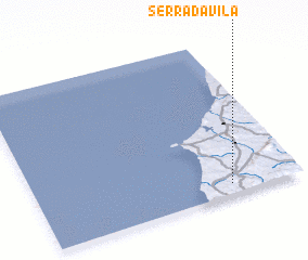 Places with similar names to Serra da Vila, Portugal ::
// Cerutiville (ZA)
// Soradoville (US)
// Sordevolo (IT)
// Surtauville (FR)
// Sortavala (RU)
// Sourdeval (FR)
Disclaimer :: Information on this page comes without warranty of any kind |
||
|
Where is Serra da Vila? Elevation and coordinates ::
Latitude (lat): 39°4'0"N Longitude (lon): 9°16'0"W
Elevation (approx.): 174m (map arrows pan, magnifying glasses zoom) |
||
|
Visiting Serra da Vila? Hotel/Accommodation ::
Book a hotel in Serra da Vila Travel Guide ::
Buy a travel guide for Portugal rental cars ::
car rental offers GPS waypoint ::
download a GPX waypoint (PoI) of Serra da Vila for your GPS receiver
|
||