|
search place name
|
||
Souto Longal (Braga, Portugal)Souto Longal is a town in the Braga region of Portugal. An overview map of the region around Souto Longal is displayed below.
regional and 3d topo map of Souto Longal, Portugal ::

Souto Longal airports ::
The nearest airport is VRL - Vila Real, located 34.8 km south east of Souto Longal.
Other airports nearby include OPO - Porto (65.6 km south west), VGO - Vigo (95.7 km north west), BGC - Braganca (112.8 km east), SCQ - Santiago (157.3 km north), Nearby towns ::
Cabeceiras de Basto (0.0km north) //
Cruz do Muro (0.0km north) //
Ponte de Pé (0.0km north) //
Arnado (1.9km north) //
Santo António (1.9km north) //
Abadim (1.9km north) //
Refojos de Basto (1.4km west) //
Raposeira (1.4km west) //
Madancos (1.4km west) //
Outeirinho (1.9km south) //
Rio Douro (2.3km north east) //
Chacim (2.3km north east) //
Souto do Rego (2.3km south east) //
Pedraça (2.3km south east) //
Tarrado (2.3km south east) //
Muro (2.3km south east) //
Alvito (2.3km south west) //
Boadela (2.8km east) //
Outeiro (2.8km west) //
Painzela (2.8km west) //
Basto (3.7km south) //
Faia (3.7km south) //
Rio Douro (4.0km north) //
Eiró (4.0km north) //
Fondevila (4.0km north) //
Asnela (3.3km north east) //
Casa (3.3km north west) //
Baloutas (3.3km north west) //
Queiroal (3.3km north west) //
[all distances 'as the bird flies' and approximate] 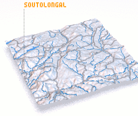 Places with similar names to Souto Longal, Portugal :: Disclaimer :: Information on this page comes without warranty of any kind |
||
|
Where is Souto Longal? Elevation and coordinates ::
Latitude (lat): 41°31'0"N Longitude (lon): 7°59'0"W
Elevation (approx.): 272m (map arrows pan, magnifying glasses zoom) |
||
|
Visiting Souto Longal? Hotel/Accommodation ::
Book a hotel in Souto Longal Travel Guide ::
Buy a travel guide for Portugal rental cars ::
car rental offers GPS waypoint ::
download a GPX waypoint (PoI) of Souto Longal for your GPS receiver
|
||