|
search place name
|
||
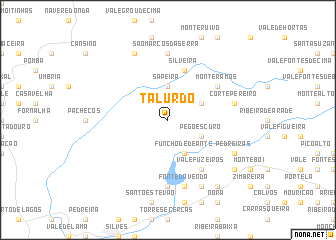
Talurdo (Faro, Portugal)Talurdo is a town in the Faro region of Portugal. An overview map of the region around Talurdo is displayed below.
regional and 3d topo map of Talurdo, Portugal ::
Talurdo airports ::
The nearest airport is FAO - Faro, located 48.8 km south east of Talurdo.
Other airports nearby include LIS - Lisbon Lisboa (177.2 km north), BJZ - Badajoz Talavera La Real (223.5 km north east), Nearby towns ::
Sapeira (3.7km north) //
Funcho de Deante (4.0km south) //
Pego Escuro (3.5km south east) //
Seiceira (3.5km north east) //
Silveira (5.8km north) //
Vale Fuzeiros (6.3km south east) //
Monte Ramos (5.8km north east) //
Casa Queimada (7.4km south) //
Barranco do Resgalho (7.4km south) //
São Marcos da Serra (7.4km north) //
Corte Pereiro (6.2km east) //
Canhestros (7.6km south) //
Fonte da Venda (7.6km south) //
Pedreiras (7.0km south east) //
Cumeada (8.0km south) //
Monte Velho (8.0km north) //
Amorosa (8.1km south east) //
Cortes (8.6km south east) //
[all distances 'as the bird flies' and approximate] 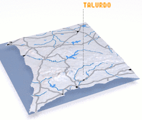 Places with similar names to Talurdo, Portugal ::
// Tala Ouerta (MA)
// Dillard (US)
// Dillard (US)
// Telluride (US)
// Dillard (US)
// Telluride (US)
// Dolorita (CU)
// Dolorita (CU)
// Dealu Roatei (RO)
// Dillard (US)
Disclaimer :: Information on this page comes without warranty of any kind |
||
|
Where is Talurdo? Elevation and coordinates ::
Latitude (lat): 37°18'0"N Longitude (lon): 8°23'0"W
Elevation (approx.): 166m (map arrows pan, magnifying glasses zoom) |
||
|
Visiting Talurdo? Hotel/Accommodation ::
Book a hotel in Talurdo Travel Guide ::
Buy a travel guide for Portugal rental cars ::
car rental offers GPS waypoint ::
download a GPX waypoint (PoI) of Talurdo for your GPS receiver
|
||