|
search place name
|
||
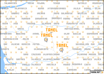
Tamel (Braga, Portugal)Tamel is a town in the Braga region of Portugal. An overview map of the region around Tamel is displayed below.
regional and 3d topo map of Tamel, Portugal ::
Tamel airports ::
The nearest airport is OPO - Porto, located 39.3 km south of Tamel.
Other airports nearby include VGO - Vigo (70.2 km north), VRL - Vila Real (84.4 km south east), SCQ - Santiago (145.1 km north), BGC - Braganca (162.8 km east), Nearby towns ::
Portela (0.0km north) //
Monte (1.4km east) //
Vila Verde (1.9km south) //
Carapeços (1.9km south) //
Agrelo (1.9km north) //
Giesta (1.9km north) //
Arieira (1.9km south) //
Campo (2.3km south east) //
Gândara (2.3km north west) //
Quintiães (2.3km north west) //
Tamel (2.3km south west) //
Aborim (2.3km north west) //
Balugães (3.7km north) //
Cossourado (3.7km north) //
Couto (2.8km east) //
Casalmelhe (2.8km east) //
Silva (3.7km south) //
Navio (4.0km north) //
Albagado (4.0km north) //
Feital (4.0km south) //
Lijó (4.0km south) //
Mouta (4.0km south) //
Paço (4.0km south) //
Vila Nova (4.0km north) //
Aparecida (4.0km north) //
Aguiar (4.0km north) //
Quiraz (3.3km south east) //
Alvito (3.3km south east) //
Varziela (4.0km south) //
[all distances 'as the bird flies' and approximate] 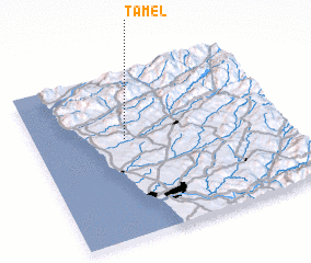 Places with similar names to Tamel, Portugal ::
Disclaimer :: Information on this page comes without warranty of any kind |
||
|
Where is Tamel? Elevation and coordinates ::
Latitude (lat): 41°36'0"N Longitude (lon): 8°38'0"W
Elevation (approx.): 212m (map arrows pan, magnifying glasses zoom) |
||
|
Visiting Tamel? Hotel/Accommodation ::
Book a hotel in Tamel Travel Guide ::
Buy a travel guide for Portugal rental cars ::
car rental offers GPS waypoint ::
download a GPX waypoint (PoI) of Tamel for your GPS receiver
|
||