|
search place name
|
||
Termo (Açores, Portugal)Termo is a town in the Açores region of Portugal. An overview map of the region around Termo is displayed below.
regional and 3d topo map of Termo, Portugal ::

Termo airports ::
The nearest airport is PDL - Ponta Delgada, located 13.1 km west of Termo.
Other airports nearby include SMA - Santa Maria (island) Santa Maria (91.0 km south), TER - Lajes (terceira Island) Lajes (176.7 km north west), Nearby towns ::
Lagoa (1.5km west) //
Santo António (1.5km west) //
Remédios (2.4km north east) //
Atalhada (2.9km west) //
Rego dʼ Água (3.7km north) //
Água de Pau (3.5km south east) //
Santo Amaro (3.5km north west) //
Cabouco (4.0km north) //
Populo (4.8km north west) //
Caloura (5.8km south east) //
Pisões (6.1km east) //
Ribeira Chã (6.1km east) //
Santa Ana (7.6km north) //
Glória (6.1km west) //
Livramento (6.1km west) //
Boa Vista (8.0km north) //
Rabo de Peixe (8.0km north) //
Gramas (9.4km north east) //
Caldeiras (9.4km north east) //
Pico da Pedra (9.4km north west) //
[all distances 'as the bird flies' and approximate] 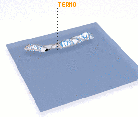 Places with similar names to Termo, Portugal ::
Disclaimer :: Information on this page comes without warranty of any kind |
||
|
Where is Termo? Elevation and coordinates ::
Latitude (lat): 37°44'0"N Longitude (lon): 25°33'0"W
Elevation (approx.): 73m (map arrows pan, magnifying glasses zoom) |
||
|
Visiting Termo? Hotel/Accommodation ::
Book a hotel in Termo Travel Guide ::
Buy a travel guide for Portugal rental cars ::
car rental offers GPS waypoint ::
download a GPX waypoint (PoI) of Termo for your GPS receiver
|
||