|
search place name
|
||
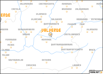
Valverde (Bragança, Portugal)Valverde is a town in the Bragança region of Portugal. An overview map of the region around Valverde is displayed below.
regional and 3d topo map of Valverde, Portugal ::
Valverde airports ::
The nearest airport is BGC - Braganca, located 64.5 km north of Valverde.
Other airports nearby include VRL - Vila Real (75.7 km west), SLM - Salamanca (116.4 km east), OPO - Porto (156.3 km west), VLL - Valladolid (170.6 km east), Nearby towns ::
Meirinhos (2.3km south west) //
Quinta de São Pedro (2.8km west) //
Quinta do Souto (3.7km north) //
Santo André (3.3km north west) //
Quinta da Roca (3.3km north west) //
Quinta das Quebradas (4.6km south east) //
Salgueiro (5.7km north) //
Legoinha (6.2km north west) //
Paradela (6.2km north east) //
Castelo Branco (5.6km east) //
Parada (5.9km west) //
Vilar Chão (7.0km north west) //
Vilar Seco (7.9km north) //
Figueira (6.7km north east) //
Quinta da Fonte Santa (7.9km south east) //
[all distances 'as the bird flies' and approximate] 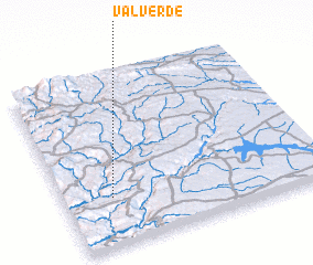 Places with similar names to Valverde, Portugal ::
// Vallefuerte (BO)
// Val Verde (US)
// Val Verde (US)
// Valley Ford (US)
// Fulford (US)
// Vale Farto (PT)
// Vale Verde (PT)
// Valverda (PT)
// Valverde (PT)
// Valverde (PT)
Disclaimer :: Information on this page comes without warranty of any kind |
||
|
Where is Valverde? Elevation and coordinates ::
Latitude (lat): 41°17'0"N Longitude (lon): 6°49'0"W
Elevation (approx.): 559m (map arrows pan, magnifying glasses zoom) |
||
|
Visiting Valverde? Hotel/Accommodation ::
Book a hotel in Valverde Travel Guide ::
Buy a travel guide for Portugal rental cars ::
car rental offers GPS waypoint ::
download a GPX waypoint (PoI) of Valverde for your GPS receiver
|
||