|
search place name
|
||
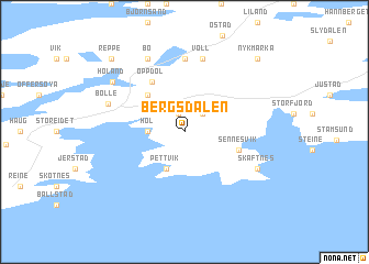
Bergsdalen (Nordland, Norway)Bergsdalen is a town in the Nordland region of Norway. An overview map of the region around Bergsdalen is displayed below.
regional and 3d topo map of Bergsdalen, Norway ::
Bergsdalen airports ::
The nearest airport is BOO - Bodoe Bodo, located 100.8 km south of Bergsdalen.
Nearby towns ::
Fygle (1.9km north) //
Hage (2.0km north) //
Berg (1.4km west) //
Hol (1.4km west) //
Pettvik (3.8km south) //
Skullbru (4.0km north) //
Sennesvik (2.8km south east) //
Oppdøl (5.3km north) //
Rise (7.4km north) //
Voll (7.4km north) //
Skaftnes (4.6km south east) //
Bø (7.5km north) //
Bolle (4.0km north west) //
Holand (5.7km north west) //
Nykmarka (7.9km north) //
Reppe (7.9km north) //
[all distances 'as the bird flies' and approximate] 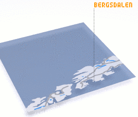 Places with similar names to Bergsdalen, Norway :: Disclaimer :: Information on this page comes without warranty of any kind |
||
|
Where is Bergsdalen? Elevation and coordinates ::
Latitude (lat): 68°8'0"N Longitude (lon): 13°40'0"E
(map arrows pan, magnifying glasses zoom) |
||
|
Visiting Bergsdalen? Hotel/Accommodation ::
Book a hotel in Bergsdalen Travel Guide ::
Buy a travel guide for Norway rental cars ::
car rental offers GPS waypoint ::
download a GPX waypoint (PoI) of Bergsdalen for your GPS receiver
|
||