|
search place name
|
||
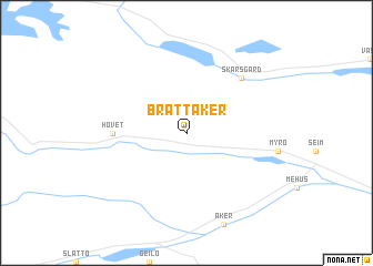
Brattåker (Buskerud, Norway)Brattåker is a town in the Buskerud region of Norway. An overview map of the region around Brattåker is displayed below.
regional and 3d topo map of Brattåker, Norway ::
Brattåker airports ::
The nearest airport is VDB - Fagernes Leirin, located 71.5 km north east of Brattåker.
Other airports nearby include SKE - Skien Geiteryggen (177.8 km south east), Nearby towns ::
 Places with similar names to Brattåker, Norway ::
// Bertigaro (IT)
// Bard-e Gūrī (IR)
// Bardehkar (IR)
// Broadacre (US)
// Bri Ātkaria (BD)
// Bara Digar (IN)
// Berdikari (ID)
// Berdikari (ID)
// Barra do Quaraí (BR)
// Bråtåkra (SE)
Disclaimer :: Information on this page comes without warranty of any kind |
||
|
Where is Brattåker? Elevation and coordinates ::
Latitude (lat): 60°38'0"N Longitude (lon): 8°14'0"E
(map arrows pan, magnifying glasses zoom) |
||
|
Visiting Brattåker? Hotel/Accommodation ::
Book a hotel in Brattåker Travel Guide ::
Buy a travel guide for Norway rental cars ::
car rental offers GPS waypoint ::
download a GPX waypoint (PoI) of Brattåker for your GPS receiver
|
||