|
search place name
|
||
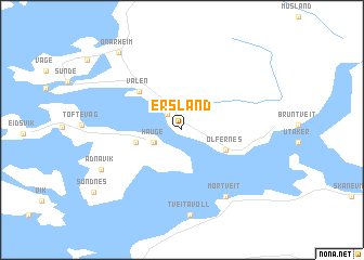
Ersland (Hordaland, Norway)Ersland is a town in the Hordaland region of Norway. An overview map of the region around Ersland is displayed below.
regional and 3d topo map of Ersland, Norway ::
Ersland airports ::
The nearest airport is SRP - Stord Sorstokken, located 27.2 km west of Ersland.
Other airports nearby include HAU - Haugesund Karmoy (61.1 km south west), BGO - Bergen Flesland (65.0 km north west), SVG - Stavanger Sola (102.8 km south), FAN - Lista (194.4 km south), Nearby towns ::
Sandvoll (1.8km north west) //
Hauge (1.9km south west) //
Høylandsbygda (2.0km south west) //
Gravdal (2.7km south west) //
Ølfernes (3.1km south east) //
Valen (4.5km north west) //
Mortveit (7.2km south) //
Tveitavoll (8.7km south) //
Ådnavik (5.9km south west) //
Onarheim (8.6km north west) //
[all distances 'as the bird flies' and approximate] 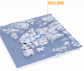 Places with similar names to Ersland, Norway ::
// Eiersland (NO)
Disclaimer :: Information on this page comes without warranty of any kind |
||
|
Where is Ersland? Elevation and coordinates ::
Latitude (lat): 59°47'42"N Longitude (lon): 5°49'33"E
Elevation (approx.): 62m (map arrows pan, magnifying glasses zoom) |
||
|
Visiting Ersland? Hotel/Accommodation ::
Book a hotel in Ersland Travel Guide ::
Buy a travel guide for Norway rental cars ::
car rental offers GPS waypoint ::
download a GPX waypoint (PoI) of Ersland for your GPS receiver
|
||