|
search place name
|
||
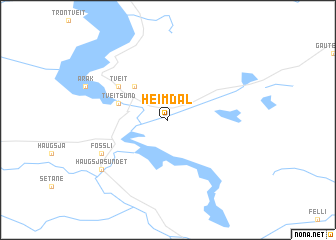
Heimdal (Telemark, Norway)Heimdal is a town in the Telemark region of Norway. An overview map of the region around Heimdal is displayed below.
regional and 3d topo map of Heimdal, Norway ::
Heimdal airports ::
The nearest airport is SKE - Skien Geiteryggen, located 60.0 km east of Heimdal.
Other airports nearby include KRS - Kristiansand Kjevik (93.2 km south), TRF - Torp (98.3 km east), FAN - Lista (151.8 km south west), TED - Thisted (215.2 km south), Nearby towns ::
Treungen (4.2km north west) //
Tveitsund (3.4km north west) //
Tveit (4.7km north west) //
Fossli (5.3km south west) //
Haugsjåsundet (6.7km south west) //
[all distances 'as the bird flies' and approximate] 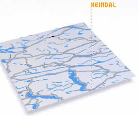 Places with similar names to Heimdal, Norway ::
// Hamed U Ali (MA)
// Heimbautal (AT)
// Homedale (US)
// Heimdal (NO)
// Heimtali (EE)
// Hamdilli (TR)
// Hamitli (TR)
// Hamitli (TR)
// Himmetli (TR)
// Ha-Madala (ZA)
Disclaimer :: Information on this page comes without warranty of any kind |
||
|
Where is Heimdal? Elevation and coordinates ::
Latitude (lat): 59°0'0"N Longitude (lon): 8°35'0"E
Elevation (approx.): 315m (map arrows pan, magnifying glasses zoom) |
||
|
Visiting Heimdal? Hotel/Accommodation ::
Book a hotel in Heimdal Travel Guide ::
Buy a travel guide for Norway rental cars ::
car rental offers GPS waypoint ::
download a GPX waypoint (PoI) of Heimdal for your GPS receiver
|
||