|
search place name
|
||
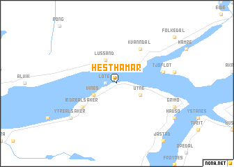
Hesthamar (Hordaland, Norway)Hesthamar is a town in the Hordaland region of Norway. An overview map of the region around Hesthamar is displayed below.
regional and 3d topo map of Hesthamar, Norway ::
Hesthamar airports ::
The nearest airport is BGO - Bergen Flesland, located 76.0 km west of Hesthamar.
Other airports nearby include SRP - Stord Sorstokken (98.8 km south west), HAU - Haugesund Karmoy (143.1 km south west), FRO - Floro (152.9 km north west), SVG - Stavanger Sola (181.1 km south), Nearby towns ::
Lote (0.9km west) //
Utne (2.6km south east) //
Vines (2.6km south west) //
Midttun (2.6km south west) //
Lussand (3.8km north) //
Kvanndal (5.9km north) //
Indre Alsåker (4.6km south west) //
Tjoflot (4.1km north east) //
Ytre Alsåker (6.7km south west) //
[all distances 'as the bird flies' and approximate] 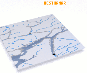 Places with similar names to Hesthamar, Norway :: Disclaimer :: Information on this page comes without warranty of any kind |
||
|
Where is Hesthamar? Elevation and coordinates ::
Latitude (lat): 60°26'0"N Longitude (lon): 6°34'0"E
(map arrows pan, magnifying glasses zoom) |
||
|
Visiting Hesthamar? Hotel/Accommodation ::
Book a hotel in Hesthamar Travel Guide ::
Buy a travel guide for Norway rental cars ::
car rental offers GPS waypoint ::
download a GPX waypoint (PoI) of Hesthamar for your GPS receiver
|
||