|
search place name
|
||
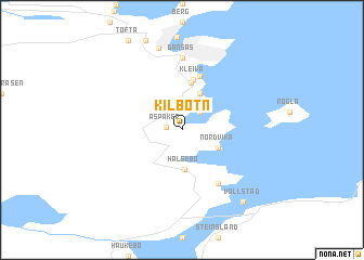
Kilbotn (Troms, Norway)Kilbotn is a town in the Troms region of Norway. An overview map of the region around Kilbotn is displayed below.
regional and 3d topo map of Kilbotn, Norway ::
Kilbotn airports ::
The nearest airport is EVE - Evenes, located 25.7 km south of Kilbotn.
Other airports nearby include ANX - Andoya (66.3 km north), BDU - Bardufoss (88.5 km north east), Nearby towns ::
Aspaker (0.6km north west) //
Breidvika (2.0km north) //
Halsebø (4.1km south) //
Osnes (3.8km north) //
Nordvika (2.3km south east) //
Mekile (4.9km north) //
Kleiva (5.2km north) //
Kanebogen (5.6km north) //
Litle Fauskevåg (5.7km south) //
Store Fauskevåg (5.7km south) //
Gansås (7.4km north) //
Seljestad (8.4km north) //
Vollstad (7.8km south) //
[all distances 'as the bird flies' and approximate] 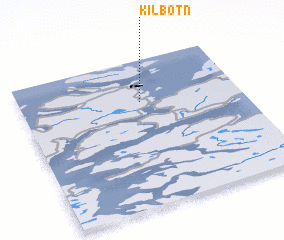 Places with similar names to Kilbotn, Norway ::
// Kǝlǝbǝdin (AZ)
// Kolbotn (NO)
// Kolobatino (UA)
// Guelbodan (TD)
// Calaba Town (SL)
// Golābdān (IR)
// Gulāb Dīn (PK)
// Gul Badan (PK)
// Gulbadīn (PK)
// Kalbat-ni (KP)
Disclaimer :: Information on this page comes without warranty of any kind |
||
|
Where is Kilbotn? Elevation and coordinates ::
Latitude (lat): 68°43'0"N Longitude (lon): 16°33'0"E
(map arrows pan, magnifying glasses zoom) |
||
|
Visiting Kilbotn? Hotel/Accommodation ::
Book a hotel in Kilbotn Travel Guide ::
Buy a travel guide for Norway rental cars ::
car rental offers GPS waypoint ::
download a GPX waypoint (PoI) of Kilbotn for your GPS receiver
|
||