|
search place name
|
||
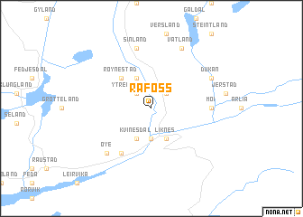
Rafoss (Vest-Agder, Norway)Rafoss is a town in the Vest-Agder region of Norway. An overview map of the region around Rafoss is displayed below.
regional and 3d topo map of Rafoss, Norway ::
Rafoss airports ::
The nearest airport is FAN - Lista, located 34.3 km south west of Rafoss.
Other airports nearby include KRS - Kristiansand Kjevik (67.6 km east), SVG - Stavanger Sola (97.0 km north west), HAU - Haugesund Karmoy (150.3 km north west), TED - Thisted (176.3 km south east), Nearby towns ::
Åmland (2.1km north east) //
Træland (2.1km north east) //
Ytre Røynestad (2.1km north west) //
Eikjeland (3.7km south) //
Liknes (3.8km south) //
Breidmoen (3.8km north) //
Kvinesdal (3.8km south) //
Røynestad (4.2km north west) //
Linland (5.9km south) //
Moi (3.9km east) //
Espeland (3.9km east) //
Sinland (7.5km north) //
Øye (6.3km south west) //
Dukan (5.4km north east) //
Vatland (7.7km north) //
[all distances 'as the bird flies' and approximate] 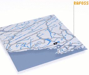 Places with similar names to Rafoss, Norway ::
Disclaimer :: Information on this page comes without warranty of any kind |
||
|
Where is Rafoss? Elevation and coordinates ::
Latitude (lat): 58°21'0"N Longitude (lon): 6°58'0"E
Elevation (approx.): 85m (map arrows pan, magnifying glasses zoom) |
||
|
Visiting Rafoss? Hotel/Accommodation ::
Book a hotel in Rafoss Travel Guide ::
Buy a travel guide for Norway rental cars ::
car rental offers GPS waypoint ::
download a GPX waypoint (PoI) of Rafoss for your GPS receiver
|
||