|
search place name
|
||
Skadberg (Rogaland, Norway)Skadberg is a town in the Rogaland region of Norway. An overview map of the region around Skadberg is displayed below.
regional and 3d topo map of Skadberg, Norway ::

Skadberg airports ::
The nearest airport is SVG - Stavanger Sola, located 1.4 km south west of Skadberg.
Other airports nearby include HAU - Haugesund Karmoy (57.3 km north west), SRP - Stord Sorstokken (102.6 km north), FAN - Lista (104.2 km south east), BGO - Bergen Flesland (158.8 km north), Nearby towns ::
Sande (0.7km north) //
Gimra (2.1km south) //
Røyneberg (2.8km north) //
Grannes (3.8km north east) //
Grønaberget (3.2km north west) //
Gausel (3.0km north east) //
Soma (3.2km south east) //
Risa (4.2km north west) //
Heigre (5.8km south) //
Sola (3.3km west) //
Stokka (3.5km east) //
Tjoraberga (4.8km north west) //
Madla (7.2km north) //
Tjelta (6.2km south) //
Sanddal (7.0km north) //
Reke (5.1km south west) //
Assheim (6.3km south east) //
Jåtta (4.9km north east) //
Skjæveland (7.7km south) //
Tananger (6.3km north west) //
Kolnes (4.5km west) //
Ølbør (4.7km south west) //
Meland (7.6km north) //
Forus (4.4km east) //
Helleland (6.6km south west) //
Revheim (8.2km north) //
Lunde (8.0km south) //
Sandnes (5.9km south east) //
Myklabost (7.9km north west) //
[all distances 'as the bird flies' and approximate] 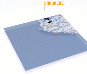 Places with similar names to Skadberg, Norway ::
// Schattberg (AT)
// Schattberg (AT)
// Schadberg (DE)
// Scheddebrock (DE)
// Schatteburg (DE)
// Schüttberg (DE)
// Skadberg (NO)
// Skadberg (NO)
// Skodborg (DK)
// Skateberg (SE)
Disclaimer :: Information on this page comes without warranty of any kind |
||
|
Where is Skadberg? Elevation and coordinates ::
Latitude (lat): 58°53'6"N Longitude (lon): 5°39'24"E
Elevation (approx.): 24m (map arrows pan, magnifying glasses zoom) |
||
|
Visiting Skadberg? Hotel/Accommodation ::
Book a hotel in Skadberg Travel Guide ::
Buy a travel guide for Norway rental cars ::
car rental offers GPS waypoint ::
download a GPX waypoint (PoI) of Skadberg for your GPS receiver
|
||