|
search place name
|
||
Solbu (Sør-Trøndelag, Norway)Solbu is a town in the Sør-Trøndelag region of Norway. An overview map of the region around Solbu is displayed below.
regional and 3d topo map of Solbu, Norway ::
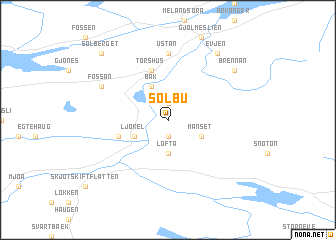
Solbu airports ::
The nearest airport is OLA - Orland, located 54.6 km north of Solbu.
Other airports nearby include TRD - Trondheim Vaernes (62.4 km north east), KSU - Kristiansund Kvernberget (100.2 km west), RRS - Roros (105.9 km south east), Nearby towns ::
Eikli (1.9km north) //
Øyum (1.9km south) //
Løfta (3.7km south) //
Månset (2.5km south east) //
Ljøkel (2.5km south west) //
Bak (3.8km north) //
Brattli (3.1km south west) //
Torshus (5.6km north) //
Ustan (7.4km north) //
Fossan (5.0km north west) //
Evjen (7.8km north) //
Brennan (6.5km north east) //
Sølberget (8.1km north west) //
[all distances 'as the bird flies' and approximate] 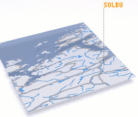 Places with similar names to Solbu, Norway ::
Disclaimer :: Information on this page comes without warranty of any kind |
||
|
Where is Solbu? Elevation and coordinates ::
Latitude (lat): 63°13'0"N Longitude (lon): 9°48'0"E
(map arrows pan, magnifying glasses zoom) |
||
|
Visiting Solbu? Hotel/Accommodation ::
Book a hotel in Solbu Travel Guide ::
Buy a travel guide for Norway rental cars ::
car rental offers GPS waypoint ::
download a GPX waypoint (PoI) of Solbu for your GPS receiver
|
||