|
search place name
|
||
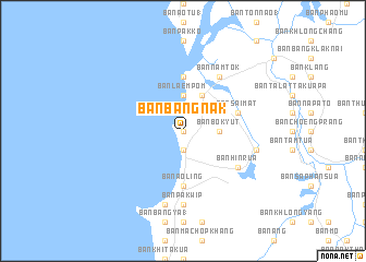
Ban Bang Nak (Phangnga, Thailand)Ban Bang Nak is a town in the Phangnga region of Thailand. An overview map of the region around Ban Bang Nak is displayed below.
regional and 3d topo map of Ban Bang Nak, Thailand ::
Ban Bang Nak airports ::
The nearest airport is HKT - Phuket Intl, located 76.2 km south of Ban Bang Nak.
Other airports nearby include NST - Nakhon Si Thammarat Cha Ian (189.4 km east), TST - Trang (206.2 km south east), Nearby towns ::
Ban Nop Bang Lam Phu (0.0km north) //
Ban Bang Sak (1.9km south) //
Ban Bang Khrok (1.9km south) //
Ban Bok Yut (3.7km east) //
Ban Laem Pom (3.7km north) //
Ban Bang Muang (4.1km north east) //
Ban Chao Nam (5.6km north) //
Ban Ao Ling (5.6km south) //
Ban Sai Mat (5.8km east) //
Ban Nam Tok (6.7km north east) //
Ban Hin Rua (6.6km south east) //
Ban Pak Wip (7.4km south) //
Ban Bang Ap (7.6km east) //
Ban Khao Ba (7.6km south) //
[all distances 'as the bird flies' and approximate] 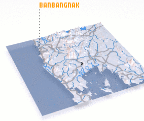 Places with similar names to Ban Bang Nak, Thailand ::
// Ban Bang Na (2) (TH)
// Ban Bang Nga (TH)
// Ban Bang Ngua (TH)
// Ban Bang Nok (TH)
// Ban Bang O Nok (TH)
// Ban Bang-Nèk (LA)
Disclaimer :: Information on this page comes without warranty of any kind |
||
|
Where is Ban Bang Nak? Elevation and coordinates ::
Latitude (lat): 8°48'0"N Longitude (lon): 98°16'0"E
Elevation (approx.): 11m (map arrows pan, magnifying glasses zoom) |
||
|
Visiting Ban Bang Nak? Hotel/Accommodation ::
Book a hotel in Ban Bang Nak Travel Guide ::
Buy a travel guide for Thailand rental cars ::
car rental offers GPS waypoint ::
download a GPX waypoint (PoI) of Ban Bang Nak for your GPS receiver
|
||