|
search place name
|
||
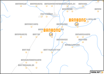
Ban Bong (Thailand)Ban Bong is a town in Thailand. An overview map of the region around Ban Bong is displayed below.
regional and 3d topo map of Ban Bong, Thailand ::
Ban Bong airports ::
The nearest airport is PHS - Phitsanulok, located 104.6 km north west of Ban Bong.
Other airports nearby include LOE - Loei (135.1 km north east), NAK - Nakhon Ratchasima Khorat (185.6 km south east), UTH - Udon Thani (208.9 km north east), PRH - Phrae (223.3 km north west), Nearby towns ::
Ban Pak Nam (0.0km north) //
Changwat Phetchabun (0.0km north) //
Ban Chon (0.0km north) //
Ban Chon Phrai (1.9km north) //
Ban Sak Haeng (2.6km north east) //
Ban Hua Na (2.6km north west) //
Ban Nam Ron (4.0km south east) //
Ban Phi (4.0km north west) //
Ban Pak Nam (5.1km north east) //
Ban Thung Kathin (5.6km south) //
Ban Khlong Samrong (5.6km south) //
Ban Tok (5.3km west) //
Ban Na Khae (6.6km south west) //
Phetchabun (7.6km north) //
Ban Nam Chang (8.0km north west) //
Ban Bu Chanuan (8.0km south east) //
Ban Phlam (8.2km north west) //
[all distances 'as the bird flies' and approximate] 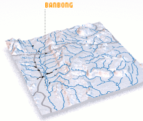 Places with similar names to Ban Bong, Thailand ::
// Banbanuag (PH)
// Binabang (PH)
// Banī Bānūk (IQ)
// Ban Baeng (TH)
// Ban Baeng (TH)
// Ban Ba Ing (TH)
// Ban Bang Hak (TH)
// Ban Bang Hak (TH)
// Ban Ba Ngo (TH)
// Ban Bang O (TH)
Disclaimer :: Information on this page comes without warranty of any kind |
||
|
Where is Ban Bong? Elevation and coordinates ::
Latitude (lat): 16°21'0"N Longitude (lon): 101°9'0"E
Elevation (approx.): 111m (map arrows pan, magnifying glasses zoom) |
||
|
Visiting Ban Bong? Hotel/Accommodation ::
Book a hotel in Ban Bong Travel Guide ::
Buy a travel guide for Thailand rental cars ::
car rental offers GPS waypoint ::
download a GPX waypoint (PoI) of Ban Bong for your GPS receiver
|
||