|
search place name
|
||
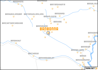
Ban Bon Na (Chiang Mai, Thailand)Ban Bon Na is a town in the Chiang Mai region of Thailand. An overview map of the region around Ban Bon Na is displayed below.
regional and 3d topo map of Ban Bon Na, Thailand ::
Ban Bon Na airports ::
The nearest airport is LPT - Lampang, located 106.7 km east of Ban Bon Na.
Other airports nearby include PRH - Phrae (177.6 km east), PHS - Phitsanulok (253.5 km south east), Nearby towns ::
Ban Om Ding (1.5km north east) //
Ban Khayang (1.6km south west) //
Ban Khun Pae (2.2km north west) //
Ban Pha Khao (3.7km north west) //
Ban Huai Manao (4.6km north) //
Ban Khae (5.2km north east) //
Ban Yang (5.5km north) //
Ban Hin Lek Fai (6.2km north) //
Ban Mak Khun (7.8km north east) //
Ban Huai Mak Nun (8.1km north east) //
Ban Som Poi (8.2km north east) //
Ban Mong Luang (8.8km north west) //
Ban Yang Um Lan Klang (9.0km north west) //
Ban Tha Rua (9.8km south west) //
[all distances 'as the bird flies' and approximate]  Places with similar names to Ban Bon Na, Thailand ::
// Banaban (PH)
// Banaban (PH)
// Banaban (PH)
// Banay-Banay (PH)
// Banaybanay (PH)
// Banaybanay (PH)
// Banaybanay (PH)
// Banaybanay (PH)
// Banaybanay (PH)
// Banban (PH)
Disclaimer :: Information on this page comes without warranty of any kind |
||
|
Where is Ban Bon Na? Elevation and coordinates ::
Latitude (lat): 18°18'21"N Longitude (lon): 98°29'45"E
Elevation (approx.): 910m (map arrows pan, magnifying glasses zoom) |
||
|
Visiting Ban Bon Na? Hotel/Accommodation ::
Book a hotel in Ban Bon Na Travel Guide ::
Buy a travel guide for Thailand rental cars ::
car rental offers GPS waypoint ::
download a GPX waypoint (PoI) of Ban Bon Na for your GPS receiver
|
||