|
search place name
|
||
Ban Bo Pat (Udon Thani, Thailand)Ban Bo Pat is a town in the Udon Thani region of Thailand. An overview map of the region around Ban Bo Pat is displayed below.
regional and 3d topo map of Ban Bo Pat, Thailand ::

Ban Bo Pat airports ::
The nearest airport is UTH - Udon Thani, located 35.3 km west of Ban Bo Pat.
Other airports nearby include VTE - Vientiane Wattay Intl (82.2 km north west), SNO - Sakon Nakhon (111.1 km east), LOE - Loei (147.5 km west), ZVK - Savannakhet (202.1 km south east), Nearby towns ::
Ban Na Sai (1.9km south) //
Ban Don Na Kham (2.1km east) //
Ban Na Yia (2.5km west) //
Ban Sabaeng (3.6km south) //
Ban Wang Hang (4.0km south west) //
Ban Chai Wan Noi (4.7km north west) //
Ban Thung Fon (5.3km south east) //
Ban Thon Noi (5.9km north west) //
Ban Bun Mi (6.7km north east) //
Ban Na Sai (6.9km north) //
Ban Khok Kong (7.1km south west) //
Ban Soi Phrao (8.0km south west) //
Ban Kham Ta Na (8.3km east) //
Ban Tha Chuang (8.4km east) //
Ban Non Nam Thaeng (9.7km north east) //
[all distances 'as the bird flies' and approximate] 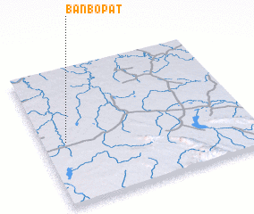 Places with similar names to Ban Bo Pat, Thailand :: Disclaimer :: Information on this page comes without warranty of any kind |
||
|
Where is Ban Bo Pat? Elevation and coordinates ::
Latitude (lat): 17°27'44"N Longitude (lon): 103°6'39"E
Elevation (approx.): 170m (map arrows pan, magnifying glasses zoom) |
||
|
Visiting Ban Bo Pat? Hotel/Accommodation ::
Book a hotel in Ban Bo Pat Travel Guide ::
Buy a travel guide for Thailand rental cars ::
car rental offers GPS waypoint ::
download a GPX waypoint (PoI) of Ban Bo Pat for your GPS receiver
|
||