|
search place name
|
||
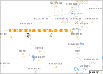
Ban Dan Mae Kham Man (Uttaradit, Thailand)Ban Dan Mae Kham Man is a town in the Uttaradit region of Thailand. An overview map of the region around Ban Dan Mae Kham Man is displayed below.
regional and 3d topo map of Ban Dan Mae Kham Man, Thailand ::
Ban Dan Mae Kham Man airports ::
The nearest airport is PRH - Phrae, located 67.7 km north of Ban Dan Mae Kham Man.
Other airports nearby include PHS - Phitsanulok (87.1 km south), LPT - Lampang (99.0 km north west), LOE - Loei (179.7 km east), Nearby towns ::
Ban Taling Tam (6.6km north west) //
Ban Phai Lom (6.6km north east) //
Ban Nong Phra Lae (6.6km north east) //
Ban Phai Khieo (6.6km north east) //
Ban Tan (6.6km south west) //
Ban Huai Khamin (7.3km west) //
Ban Wang Kaphi (7.3km east) //
Ban Dan Mae Kham Man (7.9km west) //
Ban Plai Rang (9.4km south west) //
Ban Bung Suai (10.0km south west) //
[all distances 'as the bird flies' and approximate] 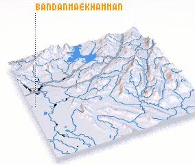 Places with similar names to Ban Dan Mae Kham Man, Thailand ::
// Ban Dan Mae Kham Man (TH)
Disclaimer :: Information on this page comes without warranty of any kind |
||
|
Where is Ban Dan Mae Kham Man? Elevation and coordinates ::
Latitude (lat): 17°32'0"N Longitude (lon): 100°2'0"E
Elevation (approx.): 59m (map arrows pan, magnifying glasses zoom) |
||
|
Visiting Ban Dan Mae Kham Man? Hotel/Accommodation ::
Book a hotel in Ban Dan Mae Kham Man Travel Guide ::
Buy a travel guide for Thailand rental cars ::
car rental offers GPS waypoint ::
download a GPX waypoint (PoI) of Ban Dan Mae Kham Man for your GPS receiver
|
||