|
search place name
|
||
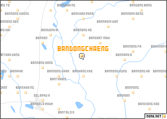
Ban Dong Chaeng (Roi Et, Thailand)Ban Dong Chaeng is a town in the Roi Et region of Thailand. An overview map of the region around Ban Dong Chaeng is displayed below.
regional and 3d topo map of Ban Dong Chaeng, Thailand ::
Ban Dong Chaeng airports ::
The nearest airport is ZVK - Savannakhet, located 91.6 km north east of Ban Dong Chaeng.
Other airports nearby include SNO - Sakon Nakhon (119.7 km north), UTH - Udon Thani (193.3 km north west), PKZ - Pakse (216.8 km south east), NAK - Nakhon Ratchasima Khorat (247.2 km south west), Nearby towns ::
Ban Wang Khe (3.7km south) //
Ban Sa-at Na Di (5.1km north east) //
Ban Nong Mo (5.6km north) //
Ban Nong Kham (6.5km south west) //
Ban Tha Bo (7.7km south west) //
Ban Nong Kung (8.0km south east) //
Ban Don Wai (9.0km north west) //
Ban Na Si Nuan (9.1km north east) //
[all distances 'as the bird flies' and approximate] 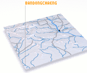 Places with similar names to Ban Dong Chaeng, Thailand ::
// Ban Tangchong (LA)
// Ban Tongchiang (LA)
// Ban Tongchong (LA)
// Bản Tông Chang (VN)
// Bản Tong Chiêng (VN)
Disclaimer :: Information on this page comes without warranty of any kind |
||
|
Where is Ban Dong Chaeng? Elevation and coordinates ::
Latitude (lat): 16°7'0"N Longitude (lon): 104°2'0"E
Elevation (approx.): 140m (map arrows pan, magnifying glasses zoom) |
||
|
Visiting Ban Dong Chaeng? Hotel/Accommodation ::
Book a hotel in Ban Dong Chaeng Travel Guide ::
Buy a travel guide for Thailand rental cars ::
car rental offers GPS waypoint ::
download a GPX waypoint (PoI) of Ban Dong Chaeng for your GPS receiver
|
||