|
search place name
|
||
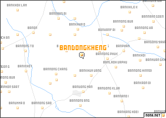
Ban Dong Kheng (Roi Et, Thailand)Ban Dong Kheng is a town in the Roi Et region of Thailand. An overview map of the region around Ban Dong Kheng is displayed below.
regional and 3d topo map of Ban Dong Kheng, Thailand ::
Ban Dong Kheng airports ::
The nearest airport is ZVK - Savannakhet, located 142.3 km north east of Ban Dong Kheng.
Other airports nearby include SNO - Sakon Nakhon (161.2 km north), NAK - Nakhon Ratchasima Khorat (197.1 km south west), UTH - Udon Thani (199.9 km north west), LOE - Loei (276.9 km north west), Nearby towns ::
Ban I Meng (4.1km south west) //
Ban Pa Sang (4.0km north west) //
Ban Khu Muang (4.1km south east) //
Muang Suang (4.0km north east) //
Ban Nong Phu (4) (5.3km east) //
Ban Ngu Luam (5.8km north) //
Ban Khwao (6.9km north) //
Ban Nong Chang (6.8km south west) //
Ban Dong Man (7.4km south) //
Ban Hua Nong (7.4km south west) //
Ban Lao Hua Phu (7.4km east) //
Ban Wan Fai (7.7km north east) //
Ban Dong Daeng (9.0km north west) //
Ban Nong Phung (9.0km south west) //
Ban Dong Klua (9.7km south east) //
Ban Nong Rua (10.7km north east) //
[all distances 'as the bird flies' and approximate] 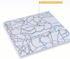 Places with similar names to Ban Dong Kheng, Thailand ::
// Ban Dong Kheng (TH)
// Ban Dong Kheng (TH)
// Ban Dong Kheng (TH)
// Ban Dong Kheng (TH)
// Ban Dong Khoang (LA)
// Ban Dôngkhoang (LA)
// Ban Dôngkhoang (LA)
// Ban Dôngkhoung (LA)
// Ban Tangkhiang (LA)
// Bản Tang Khang (VN)
Disclaimer :: Information on this page comes without warranty of any kind |
||
|
Where is Ban Dong Kheng? Elevation and coordinates ::
Latitude (lat): 15°48'0"N Longitude (lon): 103°41'0"E
Elevation (approx.): 135m (map arrows pan, magnifying glasses zoom) |
||
|
Visiting Ban Dong Kheng? Hotel/Accommodation ::
Book a hotel in Ban Dong Kheng Travel Guide ::
Buy a travel guide for Thailand rental cars ::
car rental offers GPS waypoint ::
download a GPX waypoint (PoI) of Ban Dong Kheng for your GPS receiver
|
||