|
search place name
|
||
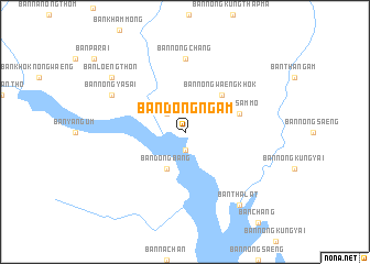
Ban Dong Ngam (Udon Thani, Thailand)Ban Dong Ngam is a town in the Udon Thani region of Thailand. An overview map of the region around Ban Dong Ngam is displayed below.
regional and 3d topo map of Ban Dong Ngam, Thailand ::
Ban Dong Ngam airports ::
The nearest airport is SNO - Sakon Nakhon, located 82.5 km east of Ban Dong Ngam.
Other airports nearby include UTH - Udon Thani (83.3 km north west), VTE - Vientiane Wattay Intl (148.2 km north west), ZVK - Savannakhet (150.3 km east), LOE - Loei (187.6 km west), Nearby towns ::
Ban Non Phak Hom (1.9km south) //
Ban Noi Han Chai (1.9km south) //
Ban Nong Waeng Khok (1.9km south) //
Ban Nong Phai (2.6km north west) //
Ban Dong Bang (4.1km south west) //
Ban Nong Waeng Khok (5.1km north east) //
Wang Sam Mo (5.6km east) //
Ban Nong Chang (7.4km north) //
Ban Nong Ya Sai (8.0km north west) //
Ban Tha Lat (9.1km south east) //
Ban Loeng Thon (9.0km north west) //
[all distances 'as the bird flies' and approximate]  Places with similar names to Ban Dong Ngam, Thailand :: Disclaimer :: Information on this page comes without warranty of any kind |
||
|
Where is Ban Dong Ngam? Elevation and coordinates ::
Latitude (lat): 16°55'0"N Longitude (lon): 103°24'0"E
Elevation (approx.): 164m (map arrows pan, magnifying glasses zoom) |
||
|
Visiting Ban Dong Ngam? Hotel/Accommodation ::
Book a hotel in Ban Dong Ngam Travel Guide ::
Buy a travel guide for Thailand rental cars ::
car rental offers GPS waypoint ::
download a GPX waypoint (PoI) of Ban Dong Ngam for your GPS receiver
|
||