|
search place name
|
||
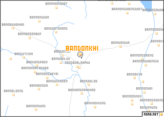
Ban Don Khi (Udon Thani, Thailand)Ban Don Khi is a town in the Udon Thani region of Thailand. An overview map of the region around Ban Don Khi is displayed below.
regional and 3d topo map of Ban Don Khi, Thailand ::
Ban Don Khi airports ::
The nearest airport is UTH - Udon Thani, located 40.7 km north east of Ban Don Khi.
Other airports nearby include LOE - Loei (80.9 km west), VTE - Vientiane Wattay Intl (86.0 km north), SNO - Sakon Nakhon (177.8 km east), Nearby towns ::
Nong Bua Lamphu (2.1km south west) //
Amphoe Nong Bua Lamphu (2.2km south) //
Ban Don Noi (4.3km west) //
Ban Huai Luk (4.7km west) //
Ban Sao Lao (6.3km south) //
Ban Wang Nam Khao (8.1km south) //
Ban Suk Kasem (8.2km south west) //
Ban Don Ya Nang (8.2km north west) //
Ban Nong Wa Yai (8.7km south west) //
Ban Huai Dua (8.8km east) //
[all distances 'as the bird flies' and approximate] 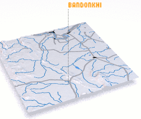 Places with similar names to Ban Don Khi, Thailand ::
// Ban Dan Kho (TH)
// Ban Din Khao (TH)
// Ban Don Kha (TH)
// Ban Don Kha (TH)
// Ban Don Kha (TH)
// Ban Don Kha (TH)
// Ban Don Kha (TH)
// Ban Don Kha (TH)
// Ban Don Kha (TH)
// Ban Don Kha (TH)
Disclaimer :: Information on this page comes without warranty of any kind |
||
|
Where is Ban Don Khi? Elevation and coordinates ::
Latitude (lat): 17°13'8"N Longitude (lon): 102°26'51"E
Elevation (approx.): 220m (map arrows pan, magnifying glasses zoom) |
||
|
Visiting Ban Don Khi? Hotel/Accommodation ::
Book a hotel in Ban Don Khi Travel Guide ::
Buy a travel guide for Thailand rental cars ::
car rental offers GPS waypoint ::
download a GPX waypoint (PoI) of Ban Don Khi for your GPS receiver
|
||