|
search place name
|
||
Ban Don Mamuang (Chumphon, Thailand)Ban Don Mamuang is a town in the Chumphon region of Thailand. An overview map of the region around Ban Don Mamuang is displayed below.
regional and 3d topo map of Ban Don Mamuang, Thailand ::

Ban Don Mamuang airports ::
The nearest airport is NST - Nakhon Si Thammarat Cha Ian, located 230.0 km south east of Ban Don Mamuang.
Nearby towns ::
Ban Huai Thon (1.9km south) //
Ban Thung Kha Tok (1.9km north) //
Ban Bang Yai (1.8km east) //
Ban Thung Kha (1.8km east) //
Ban Thung Hong (2.6km north west) //
Ban Khanai (2.6km north east) //
Ban Na (3.7km south) //
Ban Khlong Sup (4.1km south west) //
Ban Thung Kha Noi (1) (4.1km north east) //
Ban Choeng Kra (5.6km south) //
Ban Khao Bo (5.9km north) //
Ban Sai Duan (6.6km south west) //
Ban Wisai Tai (7.6km south) //
Ban Laem Manao (7.6km south) //
Ban Wisai Nua (7.6km south) //
Ban Bang Katin (1) (7.5km east) //
Ban Don Ruap (7.8km north east) //
Ban Don Sai Ngam (1) (9.2km north east) //
Ban Nong Khiam (1) (10.4km north east) //
Ban Klang Na (10.4km north east) //
[all distances 'as the bird flies' and approximate] 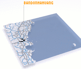 Places with similar names to Ban Don Mamuang, Thailand ::
// Ban Den Mamuang (TH)
// Ban Ton Mamuang (TH)
// Ban Ton Mamuang (TH)
// Ban Ton Mamuang (TH)
// Ban Ton Mamuang (TH)
Disclaimer :: Information on this page comes without warranty of any kind |
||
|
Where is Ban Don Mamuang? Elevation and coordinates ::
Latitude (lat): 10°23'0"N Longitude (lon): 99°8'0"E
Elevation (approx.): 23m (map arrows pan, magnifying glasses zoom) |
||
|
Visiting Ban Don Mamuang? Hotel/Accommodation ::
Book a hotel in Ban Don Mamuang Travel Guide ::
Buy a travel guide for Thailand rental cars ::
car rental offers GPS waypoint ::
download a GPX waypoint (PoI) of Ban Don Mamuang for your GPS receiver
|
||