|
search place name
|
||
Ban Don Mo Kaeng (Chaiyaphum, Thailand)Ban Don Mo Kaeng is a town in the Chaiyaphum region of Thailand. An overview map of the region around Ban Don Mo Kaeng is displayed below.
regional and 3d topo map of Ban Don Mo Kaeng, Thailand ::

Ban Don Mo Kaeng airports ::
The nearest airport is NAK - Nakhon Ratchasima Khorat, located 73.7 km south east of Ban Don Mo Kaeng.
Other airports nearby include BKK - Bangkok Intl (202.4 km south west), PHS - Phitsanulok (207.4 km north west), LOE - Loei (221.0 km north), UTH - Udon Thani (247.7 km north east), Nearby towns ::
Ban Chom Kaeo (2.1km north east) //
Ban Kut Ta Lat (2.9km south east) //
Ban Pak Chap (3.1km south west) //
Ban Phet (5.4km east) //
Ban Khok Hin Tang (5.7km south) //
Ban Nong Waeng (5.7km east) //
Ban Nong Han (6.5km south) //
Ban Khok Roeng Rom (6.5km south west) //
Ban Makok Ngam (7.0km north west) //
Bamnet Narong (8.5km north east) //
Ban Wang Sanuan (8.6km south west) //
Ban Na Lalai (8.5km north west) //
Ban Khok (8.5km east) //
Ban Buda (8.9km south) //
Ban Nong Kok (10.0km south east) //
[all distances 'as the bird flies' and approximate] 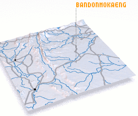 Places with similar names to Ban Don Mo Kaeng, Thailand :: Disclaimer :: Information on this page comes without warranty of any kind |
||
|
Where is Ban Don Mo Kaeng? Elevation and coordinates ::
Latitude (lat): 15°26'37"N Longitude (lon): 101°38'9"E
Elevation (approx.): 231m (map arrows pan, magnifying glasses zoom) |
||
|
Visiting Ban Don Mo Kaeng? Hotel/Accommodation ::
Book a hotel in Ban Don Mo Kaeng Travel Guide ::
Buy a travel guide for Thailand rental cars ::
car rental offers GPS waypoint ::
download a GPX waypoint (PoI) of Ban Don Mo Kaeng for your GPS receiver
|
||