|
search place name
|
||
Ban Fa Huan (Ubon Ratchathani, Thailand)Ban Fa Huan is a town in the Ubon Ratchathani region of Thailand. An overview map of the region around Ban Fa Huan is displayed below.
regional and 3d topo map of Ban Fa Huan, Thailand ::

Ban Fa Huan airports ::
The nearest airport is ZVK - Savannakhet, located 102.0 km north of Ban Fa Huan.
Other airports nearby include PKZ - Pakse (120.2 km south east), SNO - Sakon Nakhon (186.9 km north), Nearby towns ::
Ban Na Di (1.9km north) //
Ban Tha Lat (2.2km south) //
Ban Rai Khi (3.6km north) //
Ban Bua Yang (3.8km south west) //
Ban Na Sabaeng (5.1km south east) //
Ban Kung Chai (6.8km north west) //
Ban Nong Muang (7.2km south west) //
Ban Nong Chang Yai (8.0km south) //
Ban Dong Bang (8.3km north west) //
Ban Si Khun (8.7km south east) //
Ban Nong Saeng (8.7km south west) //
Ban Don Chi (10.2km north east) //
[all distances 'as the bird flies' and approximate] 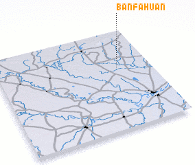 Places with similar names to Ban Fa Huan, Thailand ::
// Ban Fa Huan (TH)
// Ban Fa Huan (TH)
// Ban Fa Huan (TH)
// Ban Fai Hin (TH)
// Ban Phu Haen (TH)
// Ban Phahan (LA)
// Ban Phahan (LA)
// Ban Phahan (LA)
// Ban Phahèn (LA)
// Ban Phahin (LA)
Disclaimer :: Information on this page comes without warranty of any kind |
||
|
Where is Ban Fa Huan? Elevation and coordinates ::
Latitude (lat): 15°38'7"N Longitude (lon): 104°47'22"E
Elevation (approx.): 136m (map arrows pan, magnifying glasses zoom) |
||
|
Visiting Ban Fa Huan? Hotel/Accommodation ::
Book a hotel in Ban Fa Huan Travel Guide ::
Buy a travel guide for Thailand rental cars ::
car rental offers GPS waypoint ::
download a GPX waypoint (PoI) of Ban Fa Huan for your GPS receiver
|
||