|
search place name
|
||
Ban Hat Noi (Uttaradit, Thailand)Ban Hat Noi is a town in the Uttaradit region of Thailand. An overview map of the region around Ban Hat Noi is displayed below.
regional and 3d topo map of Ban Hat Noi, Thailand ::

Ban Hat Noi airports ::
The nearest airport is PRH - Phrae, located 43.3 km west of Ban Hat Noi.
Other airports nearby include LPT - Lampang (114.7 km west), PHS - Phitsanulok (137.7 km south), LOE - Loei (139.0 km south east), LPQ - Luang Prabang Luang Phabang Intl (270.0 km north east), Nearby towns ::
Ban Pak Nam Li (3.7km north) //
Ban Pak Li (3.7km north) //
Ban Tha Faek (1) (4.0km south west) //
Ban Huai Faek (4.1km south east) //
Ban Tong (6.6km north west) //
Ban Pak Huai Un (7.4km north) //
Ban Huai Oi (7.7km south west) //
Ban Huai Ta (7.7km west) //
Ban Cham Khian (9.0km north west) //
Ban Hat La Nua (10.2km south west) //
[all distances 'as the bird flies' and approximate] 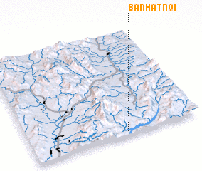 Places with similar names to Ban Hat Noi, Thailand ::
// Beni Hadaïn (MA)
// Ban Hat Tun (TH)
// Ban Hua Ai Duan (TH)
// Ban Hua Dan (TH)
// Ban Hua Dan (TH)
// Ban Hua Dan (TH)
// Ban Hua Den (TH)
// Ban Hua Den (TH)
// Ban Hua Don (TH)
// Ban Hua Don (TH)
Disclaimer :: Information on this page comes without warranty of any kind |
||
|
Where is Ban Hat Noi? Elevation and coordinates ::
Latitude (lat): 18°0'0"N Longitude (lon): 100°33'0"E
Elevation (approx.): 232m (map arrows pan, magnifying glasses zoom) |
||
|
Visiting Ban Hat Noi? Hotel/Accommodation ::
Book a hotel in Ban Hat Noi Travel Guide ::
Buy a travel guide for Thailand rental cars ::
car rental offers GPS waypoint ::
download a GPX waypoint (PoI) of Ban Hat Noi for your GPS receiver
|
||