|
search place name
|
||
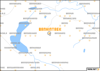
Ban Hin Taek (Sakon Nakhon, Thailand)Ban Hin Taek is a town in the Sakon Nakhon region of Thailand. An overview map of the region around Ban Hin Taek is displayed below.
regional and 3d topo map of Ban Hin Taek, Thailand ::
Ban Hin Taek airports ::
The nearest airport is SNO - Sakon Nakhon, located 31.4 km east of Ban Hin Taek.
Other airports nearby include UTH - Udon Thani (111.9 km west), ZVK - Savannakhet (126.1 km south east), VTE - Vientiane Wattay Intl (156.7 km north west), Nearby towns ::
Ban Sawang (3.5km east) //
Ban Phok Noi (3.5km east) //
Ban Hai (5.1km north east) //
Ban Kham Wae (5.3km west) //
Ban Rai (6.5km north east) //
Ban Nong Wai (7.1km west) //
Ban Sao Khwan (7.1km west) //
Amphoe Phanna Nikhom (7.1km west) //
Ban Kham Kha (7.1km east) //
Ban Na Nai (7.4km south) //
Ban Nong Dok (7.6km north) //
Ban Nong Phu (7.6km south) //
Ban Huai Bun (7.7km south west) //
Ban Muang Khai (8.2km north east) //
Ban Khamin (9.1km north east) //
Ban Nong Hai Noi (9.0km north west) //
Ban Wang Yang (9.0km north east) //
Ban Puai (10.2km north east) //
[all distances 'as the bird flies' and approximate]  Places with similar names to Ban Hin Taek, Thailand ::
// Ban Hin Taek (TH)
// Ban Hin Taek (TH)
// Ban Hin Tok (TH)
// Ban Na Hin Tok (TH)
// Ban Hintèk (LA)
Disclaimer :: Information on this page comes without warranty of any kind |
||
|
Where is Ban Hin Taek? Elevation and coordinates ::
Latitude (lat): 17°16'0"N Longitude (lon): 103°50'0"E
Elevation (approx.): 209m (map arrows pan, magnifying glasses zoom) |
||
|
Visiting Ban Hin Taek? Hotel/Accommodation ::
Book a hotel in Ban Hin Taek Travel Guide ::
Buy a travel guide for Thailand rental cars ::
car rental offers GPS waypoint ::
download a GPX waypoint (PoI) of Ban Hin Taek for your GPS receiver
|
||