|
search place name
|
||
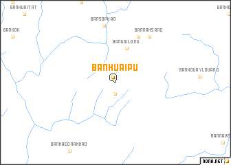
Ban Huai Pu (Nan, Thailand)Ban Huai Pu is a town in the Nan region of Thailand. An overview map of the region around Ban Huai Pu is displayed below.
regional and 3d topo map of Ban Huai Pu, Thailand ::
Ban Huai Pu airports ::
The nearest airport is PRH - Phrae, located 141.3 km south west of Ban Huai Pu.
Other airports nearby include LPQ - Luang Prabang Luang Phabang Intl (147.3 km north east), LOE - Loei (169.8 km south), VTE - Vientiane Wattay Intl (173.0 km south east), LPT - Lampang (195.3 km west), Nearby towns ::
Ban Maeo Lao La (1.9km south) //
Ban Doi Long (5.8km north) //
Ban Khun Wa Tai Yao (8.2km north east) //
Ban Nam Sang (9.1km north east) //
[all distances 'as the bird flies' and approximate] 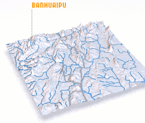 Places with similar names to Ban Huai Pu, Thailand ::
// Ban Hoep (TH)
// Ban Huai Pao (TH)
// Ban Huai Pao (TH)
// Ban Huai Pao (TH)
// Ban Huai Po (TH)
// Ban Huai Po (TH)
// Ban Huai Pu (TH)
// Ban Huai Pu (TH)
// Ban Huai Pu (TH)
// Ban Huai Pu (TH)
Disclaimer :: Information on this page comes without warranty of any kind |
||
|
Where is Ban Huai Pu? Elevation and coordinates ::
Latitude (lat): 18°54'0"N Longitude (lon): 101°14'0"E
Elevation (approx.): 1426m (map arrows pan, magnifying glasses zoom) |
||
|
Visiting Ban Huai Pu? Hotel/Accommodation ::
Book a hotel in Ban Huai Pu Travel Guide ::
Buy a travel guide for Thailand rental cars ::
car rental offers GPS waypoint ::
download a GPX waypoint (PoI) of Ban Huai Pu for your GPS receiver
|
||