|
search place name
|
||
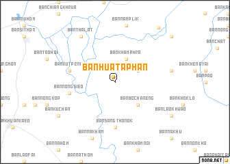
Ban Hua Taphan (Amnat Charoen, Thailand)Ban Hua Taphan is a town in the Amnat Charoen region of Thailand. An overview map of the region around Ban Hua Taphan is displayed below.
regional and 3d topo map of Ban Hua Taphan, Thailand ::
Ban Hua Taphan airports ::
The nearest airport is ZVK - Savannakhet, located 98.1 km north of Ban Hua Taphan.
Other airports nearby include PKZ - Pakse (155.2 km south east), SNO - Sakon Nakhon (167.8 km north), UTH - Udon Thani (257.4 km north west), Nearby towns ::
Ban Dong Ton (4.0km north east) //
Ban Kham Phra (4.1km north east) //
Ban Bo Chaneng (5.1km south east) //
Ban Sang Tho Nok (7.4km south) //
Ban Kut Peng (7.4km west) //
Ban Nong Sieo (7.4km west) //
Ban Tha Lat (9.1km north west) //
Ban Kham Sang Bo (11.2km north east) //
[all distances 'as the bird flies' and approximate] 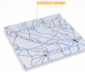 Places with similar names to Ban Hua Taphan, Thailand ::
Disclaimer :: Information on this page comes without warranty of any kind |
||
|
Where is Ban Hua Taphan? Elevation and coordinates ::
Latitude (lat): 15°43'0"N Longitude (lon): 104°28'0"E
Elevation (approx.): 140m (map arrows pan, magnifying glasses zoom) |
||
|
Visiting Ban Hua Taphan? Hotel/Accommodation ::
Book a hotel in Ban Hua Taphan Travel Guide ::
Buy a travel guide for Thailand rental cars ::
car rental offers GPS waypoint ::
download a GPX waypoint (PoI) of Ban Hua Taphan for your GPS receiver
|
||