|
search place name
|
||
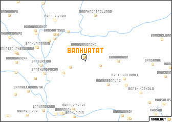
Ban Hua Tat (Mae Hong Son, Thailand)Ban Hua Tat is a town in the Mae Hong Son region of Thailand. An overview map of the region around Ban Hua Tat is displayed below.
regional and 3d topo map of Ban Hua Tat, Thailand ::
Ban Hua Tat airports ::
The nearest airport is LPT - Lampang, located 161.3 km east of Ban Hua Tat.
Other airports nearby include RGN - Yangon Intl (263.6 km south west), THL - Tachilek Tachileik (300.7 km north east), Nearby towns ::
Ban Huai Kong Ko (2.8km north) //
Ban Yang Mae Hu (3.2km east) //
Ban Mae Pang Nai (3.5km south west) //
Ban Mae Pang Nok (5.3km south west) //
Ban Huai Hom (6.7km east) //
Ban Mae Sapung (7.0km south east) //
Ban Hua La (7.4km north west) //
Ban Mae La Luang (8.1km north west) //
Ban Thung Pa Kha (8.3km north west) //
Ban Santi Suk (8.8km north west) //
Ban Santi Phatthana (8.8km north west) //
Ban Thi Khlo Khli (8.9km south east) //
Ban Mae Samaeng (9.9km south east) //
[all distances 'as the bird flies' and approximate] 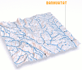 Places with similar names to Ban Hua Tat, Thailand ::
// Ban Huai Dua Tai (TH)
// Ban Huai Tat (TH)
// Ban Huai Tat (TH)
// Ban Huai Tat (TH)
// Ban Huai Tat (TH)
// Ban Huai Tat (TH)
// Ban Huai Tat (TH)
// Ban Huai To (3) (TH)
// Ban Hatdi (LA)
// Ban Hat Douei (LA)
Disclaimer :: Information on this page comes without warranty of any kind |
||
|
Where is Ban Hua Tat? Elevation and coordinates ::
Latitude (lat): 18°29'9"N Longitude (lon): 97°59'39"E
Elevation (approx.): 701m (map arrows pan, magnifying glasses zoom) |
||
|
Visiting Ban Hua Tat? Hotel/Accommodation ::
Book a hotel in Ban Hua Tat Travel Guide ::
Buy a travel guide for Thailand rental cars ::
car rental offers GPS waypoint ::
download a GPX waypoint (PoI) of Ban Hua Tat for your GPS receiver
|
||