|
search place name
|
||
Ban Kaeng Chin (2) (Kanchanaburi, Thailand)Ban Kaeng Chin (2) is a town in the Kanchanaburi region of Thailand. An overview map of the region around Ban Kaeng Chin (2) is displayed below.
regional and 3d topo map of Ban Kaeng Chin (2), Thailand ::

Ban Kaeng Chin (2) airports ::
The nearest airport is BKK - Bangkok Intl, located 129.0 km east of Ban Kaeng Chin (2).
Other airports nearby include HHQ - Prachuap Khiri Khan Hua Hin (168.9 km south), MGZ - Myeik (200.5 km south west), UTP - Rayong U Taphao Intl (230.4 km south east), Nearby towns ::
Ban Phu Liap (1.4km north west) //
Ban Rai Pa Yoe (2.4km north east) //
Ban Lat Ya (2.8km north) //
Ban Nong Bua (1) (2.8km south east) //
Ban Chan Ui (4.0km north west) //
Ban Tha Sao (4.9km north west) //
Ban Nam Chon (5.3km north west) //
Ban Tha Phaniat (5.9km east) //
Ban Wang Wa (6.5km north west) //
Ban Ko Krang (6.5km east) //
Ban Tha Nam Tun (6.9km east) //
Ban Hua Hin (7.8km south east) //
Ban Wang Dong (7.8km north west) //
Ban Tha Makham (8.2km east) //
Ban Lum Makok (8.4km north) //
Ban Yang (1) (10.3km south east) //
Ban Khao Pun (11.5km south east) //
[all distances 'as the bird flies' and approximate] 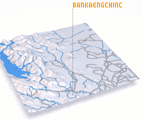 Places with similar names to Ban Kaeng Chin (2), Thailand ::
// Ban Kèngchèng (LA)
// Ban Kèngchong (LA)
Disclaimer :: Information on this page comes without warranty of any kind |
||
|
Where is Ban Kaeng Chin (2)? Elevation and coordinates ::
Latitude (lat): 14°4'22"N Longitude (lon): 99°25'25"E
Elevation (approx.): 39m (map arrows pan, magnifying glasses zoom) |
||
|
Visiting Ban Kaeng Chin (2)? Hotel/Accommodation ::
Book a hotel in Ban Kaeng Chin (2) Travel Guide ::
Buy a travel guide for Thailand rental cars ::
car rental offers GPS waypoint ::
download a GPX waypoint (PoI) of Ban Kaeng Chin (2) for your GPS receiver
|
||