|
search place name
|
||
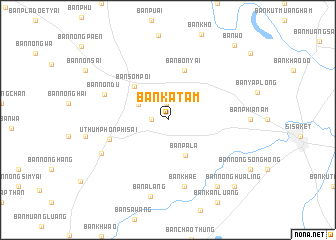
Ban Katam (Sisaket, Thailand)Ban Katam is a town in the Sisaket region of Thailand. An overview map of the region around Ban Katam is displayed below.
regional and 3d topo map of Ban Katam, Thailand ::
Ban Katam airports ::
The nearest airport is ZVK - Savannakhet, located 168.5 km north of Ban Katam.
Other airports nearby include PKZ - Pakse (170.0 km east), REP - Siem-reap Siem Reap (195.1 km south), Nearby towns ::
Ban Nong Lung (1.8km north) //
Ban Yang (1.8km west) //
Ban Kasem Suk (3.6km north west) //
Ban Pala (4.4km south east) //
Ban Som Poi (5.2km north west) //
Ban Bon Yai (5.8km north) //
Uthumphon Phisai (6.7km west) //
Ban Non Du (7.4km north west) //
Ban Khae (7.6km south) //
Ban Kamphaeng (8.1km south west) //
Ban Alang (8.8km south) //
Ban Makkhiap (9.2km south east) //
Ban Nong Hua Ling (10.3km south east) //
Ban Wo (11.0km north east) //
[all distances 'as the bird flies' and approximate]  Places with similar names to Ban Katam, Thailand ::
// Ban Kae Dam (TH)
// Ban Kao Tum (TH)
// Ban Katam (TH)
// Ban Katum (1) (TH)
// Ban Ko Ta Moi (TH)
// Ban Kut Tum (TH)
// Bengdom (BD)
// Banaketembo (CD)
// Bena-Kadima (CD)
// Bena-Kadimbo (CD)
Disclaimer :: Information on this page comes without warranty of any kind |
||
|
Where is Ban Katam? Elevation and coordinates ::
Latitude (lat): 15°8'0"N Longitude (lon): 104°12'0"E
Elevation (approx.): 132m (map arrows pan, magnifying glasses zoom) |
||
|
Visiting Ban Katam? Hotel/Accommodation ::
Book a hotel in Ban Katam Travel Guide ::
Buy a travel guide for Thailand rental cars ::
car rental offers GPS waypoint ::
download a GPX waypoint (PoI) of Ban Katam for your GPS receiver
|
||