|
search place name
|
||
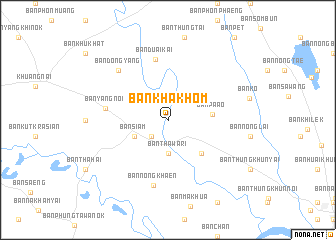
Ban Kha Khom (Ubon Ratchathani, Thailand)Ban Kha Khom is a town in the Ubon Ratchathani region of Thailand. An overview map of the region around Ban Kha Khom is displayed below.
regional and 3d topo map of Ban Kha Khom, Thailand ::
Ban Kha Khom airports ::
The nearest airport is PKZ - Pakse, located 120.4 km east of Ban Kha Khom.
Other airports nearby include ZVK - Savannakhet (133.8 km north), SNO - Sakon Nakhon (212.9 km north), REP - Siem-reap Siem Reap (234.2 km south west), Nearby towns ::
Ban Khaem (2.6km south west) //
Ban Tha Wari (3.7km south) //
Ban Hua Don (3.7km south) //
Ban Siam (4.0km south west) //
Ban Pa Ao (4.9km east) //
Ban Nong Chang (5.1km south east) //
Ban Duai Kai (6.9km north) //
Ban Yang Noi (6.9km west) //
Ban Nong Khaen (7.5km south) //
Ban Dong Yang (7.7km north west) //
[all distances 'as the bird flies' and approximate] 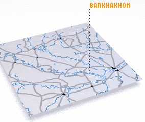 Places with similar names to Ban Kha Khom, Thailand ::
// Ban Khok Hom (TH)
// Ban Khok Hom (1) (TH)
// Ban Khok Kham (TH)
// Ban Khok Kham (TH)
// Ban Khok Kham (TH)
// Ban Khok Kham (TH)
// Ban Khok Kham (TH)
// Ban Khok Kham (TH)
// Ban Khok Kham (TH)
// Ban Khok Kham (TH)
Disclaimer :: Information on this page comes without warranty of any kind |
||
|
Where is Ban Kha Khom? Elevation and coordinates ::
Latitude (lat): 15°21'0"N Longitude (lon): 104°41'0"E
Elevation (approx.): 118m (map arrows pan, magnifying glasses zoom) |
||
|
Visiting Ban Kha Khom? Hotel/Accommodation ::
Book a hotel in Ban Kha Khom Travel Guide ::
Buy a travel guide for Thailand rental cars ::
car rental offers GPS waypoint ::
download a GPX waypoint (PoI) of Ban Kha Khom for your GPS receiver
|
||