|
search place name
|
||
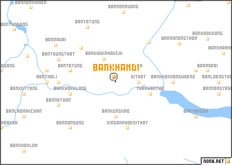
Ban Kham Di (Udon Thani, Thailand)Ban Kham Di is a town in the Udon Thani region of Thailand. An overview map of the region around Ban Kham Di is displayed below.
regional and 3d topo map of Ban Kham Di, Thailand ::
Ban Kham Di airports ::
The nearest airport is UTH - Udon Thani, located 62.6 km north west of Ban Kham Di.
Other airports nearby include SNO - Sakon Nakhon (102.7 km east), VTE - Vientiane Wattay Intl (130.9 km north west), LOE - Loei (164.0 km west), ZVK - Savannakhet (174.1 km east), Nearby towns ::
Ban Kham Moei (2.6km north east) //
Ban Nong Thom (2.6km north east) //
Si That (3.5km east) //
Ban Khok Phakchi (4.2km north west) //
Ban Kung Kao (5.6km south) //
Tha Khantho (5.6km east) //
Ban Tat Ung (7.3km west) //
Ban Non Muang (7.3km west) //
Ban Khok Phakchi (7.3km west) //
Ban Khok Klang (7.3km west) //
Amphoe Tha Khantho (7.6km south) //
Ban Koeng (7.6km south) //
King Amphoe Si That (7.6km south) //
Ban Kham Khaen (7.7km north west) //
Ban Kut I Thao (8.3km north east) //
Ban Kut Khon Kaen (10.3km south west) //
Ban Non Sung (10.3km south west) //
[all distances 'as the bird flies' and approximate] 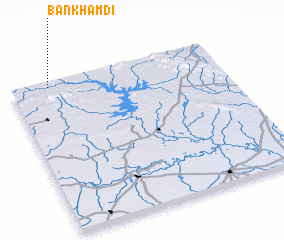 Places with similar names to Ban Kham Di, Thailand ::
// Ban Kham Bit (TH)
// Ban Kham Bit (TH)
// Ban Kham Duai (TH)
// Ban Kham Duai (TH)
// Ban Kham Maet (TH)
// Ban Kham Muat (TH)
// Ban Kham Muat (TH)
// Ban Kham Mut (TH)
// Ban Kham Toei (TH)
// Ban Kham Toei (TH)
Disclaimer :: Information on this page comes without warranty of any kind |
||
|
Where is Ban Kham Di? Elevation and coordinates ::
Latitude (lat): 16°58'0"N Longitude (lon): 103°11'0"E
Elevation (approx.): 163m (map arrows pan, magnifying glasses zoom) |
||
|
Visiting Ban Kham Di? Hotel/Accommodation ::
Book a hotel in Ban Kham Di Travel Guide ::
Buy a travel guide for Thailand rental cars ::
car rental offers GPS waypoint ::
download a GPX waypoint (PoI) of Ban Kham Di for your GPS receiver
|
||