|
search place name
|
||
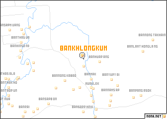
Ban Khlong Kum (Sara Buri, Thailand)Ban Khlong Kum is a town in the Sara Buri region of Thailand. An overview map of the region around Ban Khlong Kum is displayed below.
regional and 3d topo map of Ban Khlong Kum, Thailand ::
Ban Khlong Kum airports ::
The nearest airport is NAK - Nakhon Ratchasima Khorat, located 99.1 km east of Ban Khlong Kum.
Other airports nearby include BKK - Bangkok Intl (109.2 km south west), Nearby towns ::
Ban Kaeng Manao (1.5km south) //
Ban Hua Pang (3.5km east) //
Ban Mak (4.7km south) //
Ban Nong Kabao (6.2km south west) //
Ban Mo Maklua (6.4km south) //
Ban Tha Maprang (6.5km south) //
Muaklek (6.9km south) //
Ban Sap Bon (7.1km south) //
Ban Yup Yai (7.6km south east) //
Ban Muak Lek (8.3km south) //
Ban Saphan Si (8.8km south west) //
Ban Tham Tao (9.4km south east) //
Ban Nam Sap (10.0km south east) //
[all distances 'as the bird flies' and approximate]  Places with similar names to Ban Khlong Kum, Thailand ::
Disclaimer :: Information on this page comes without warranty of any kind |
||
|
Where is Ban Khlong Kum? Elevation and coordinates ::
Latitude (lat): 14°43'23"N Longitude (lon): 101°11'3"E
Elevation (approx.): 178m (map arrows pan, magnifying glasses zoom) |
||
|
Visiting Ban Khlong Kum? Hotel/Accommodation ::
Book a hotel in Ban Khlong Kum Travel Guide ::
Buy a travel guide for Thailand rental cars ::
car rental offers GPS waypoint ::
download a GPX waypoint (PoI) of Ban Khlong Kum for your GPS receiver
|
||